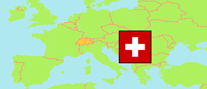
Bezirk Thal
District in Solothurn
District
The population development of Bezirk Thal.
| Name | Status | Population Census 1980-12-02 | Population Census 1990-12-04 | Population Census 2000-12-05 | Population Estimate 2010-12-31 | Population Estimate 2020-12-31 | Population Estimate 2023-12-31 | |
|---|---|---|---|---|---|---|---|---|
| Bezirk Thal | District | 12,773 | 13,587 | 14,038 | 14,216 | 14,752 | 15,381 | → |
| Solothurn | Canton | 218,102 | 231,746 | 244,341 | 255,284 | 277,462 | 286,751 |
Contents: Cities and Communes
The population development of the cities and communes in Bezirk Thal.
| Name | Status | District | Population Census 1980-12-02 | Population Census 1990-12-04 | Population Census 2000-12-05 | Population Estimate 2010-12-31 | Population Estimate 2020-12-31 | Population Estimate 2023-12-31 | |
|---|---|---|---|---|---|---|---|---|---|
| Aedermannsdorf | Commune | Bezirk Thal | 461 | 501 | 543 | 562 | 581 | 599 | → |
| Balsthal | Commune | Bezirk Thal | 5,090 | 5,405 | 5,574 | 5,772 | 6,210 | 6,499 | → |
| Herbetswil | Commune | Bezirk Thal | 587 | 596 | 568 | 541 | 568 | 605 | → |
| Holderbank (SO) | Commune | Bezirk Thal | 570 | 608 | 589 | 629 | 705 | 753 | → |
| Laupersdorf | Commune | Bezirk Thal | 1,380 | 1,520 | 1,651 | 1,685 | 1,810 | 1,896 | → |
| Matzendorf | Commune | Bezirk Thal | 1,077 | 1,218 | 1,305 | 1,290 | 1,321 | 1,374 | → |
| Mümliswil-Ramiswil | Commune | Bezirk Thal | 2,386 | 2,455 | 2,553 | 2,513 | 2,386 | 2,450 | → |
| Welschenrohr-Gänsbrunnen | Commune | Bezirk Thal | 1,222 | 1,284 | 1,255 | 1,224 | 1,171 | 1,205 | → |
Source: Swiss Federal Statistical Office.
Explanation: Districts and communes in the boundaries of December 2023. The population figures for 2023 are preliminary.