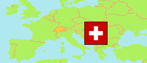
Bezirk Gäu
District in Solothurn
District
The population development of Bezirk Gäu.
| Name | Status | Population Census 1980-12-02 | Population Census 1990-12-04 | Population Census 2000-12-05 | Population Estimate 2010-12-31 | Population Estimate 2020-12-31 | Population Estimate 2023-12-31 | |
|---|---|---|---|---|---|---|---|---|
| Bezirk Gäu | District | 12,740 | 14,429 | 16,737 | 18,135 | 22,005 | 23,070 | → |
| Solothurn | Canton | 218,102 | 231,746 | 244,341 | 255,284 | 277,462 | 286,751 |
Contents: Cities and Communes
The population development of the cities and communes in Bezirk Gäu.
| Name | Status | District | Population Census 1980-12-02 | Population Census 1990-12-04 | Population Census 2000-12-05 | Population Estimate 2010-12-31 | Population Estimate 2020-12-31 | Population Estimate 2023-12-31 | |
|---|---|---|---|---|---|---|---|---|---|
| Egerkingen | Commune | Bezirk Gäu | 2,152 | 2,539 | 2,884 | 3,136 | 4,041 | 4,299 | → |
| Härkingen | Commune | Bezirk Gäu | 837 | 985 | 1,196 | 1,332 | 1,644 | 1,766 | → |
| Kestenholz | Commune | Bezirk Gäu | 1,247 | 1,387 | 1,617 | 1,661 | 1,848 | 1,881 | → |
| Neuendorf | Commune | Bezirk Gäu | 1,201 | 1,451 | 1,796 | 1,897 | 2,277 | 2,405 | → |
| Niederbuchsiten | Commune | Bezirk Gäu | 662 | 788 | 947 | 959 | 1,260 | 1,301 | → |
| Oberbuchsiten | Commune | Bezirk Gäu | 1,421 | 1,549 | 1,841 | 1,906 | 2,296 | 2,385 | → |
| Oensingen | Commune | Bezirk Gäu | 3,543 | 3,931 | 4,517 | 5,229 | 6,276 | 6,632 | → |
| Wolfwil | Commune | Bezirk Gäu | 1,677 | 1,799 | 1,939 | 2,015 | 2,363 | 2,401 | → |
Source: Swiss Federal Statistical Office.
Explanation: Districts and communes in the boundaries of December 2023. The population figures for 2023 are preliminary.