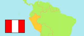
Piura
Province in Piura Region
Contents: Subdivision
The population development in Piura as well as related information and services (Wikipedia, Google, images).
| Name | Status | Population Census 1993-07-11 | Population Census 2007-10-21 | Population Census 2017-10-22 | Population Projection 2022-06-30 | |
|---|---|---|---|---|---|---|
| Piura | Province | 502,339 | 665,991 | 828,343 | 929,063 | |
| Castilla | District | 91,442 | 123,692 | 166,684 | 193,225 | → |
| Catacaos | District | 54,117 | 66,308 | 76,494 | 82,839 | → |
| Cura Mori | District | 13,733 | 16,923 | 19,065 | 20,441 | → |
| El Tallán | District | 4,334 | 4,774 | 5,453 | 5,643 | → |
| La Arena | District | 28,742 | 34,584 | 39,174 | 42,102 | → |
| Las Lomas | District | 26,302 | 26,896 | 28,287 | 29,345 | → |
| La Unión | District | 27,935 | 36,000 | 41,826 | 45,471 | → |
| Piura | District | ... | ... | 164,791 | 184,732 | → |
| Tambo Grande | District | 63,183 | 96,451 | 115,877 | 128,004 | → |
| Veintiséis de Octubre (← Piura) | District | ... | ... | 170,692 | 197,261 | → |
| Piura | Region | 1,388,264 | 1,676,315 | 1,929,970 | 2,103,099 |
Source: Instituto Nacional de Estadística e Informática, Peru (web).
Explanation: The tabulated results of the 2017 census are adjusted for underenumeration. Area figures are computed by using geospatial data.
Further information about the population structure:
| Gender (C 2017) | |
|---|---|
| Males | 409,954 |
| Females | 418,389 |
| Age Groups (C 2017) | |
|---|---|
| 0-14 years | 237,787 |
| 15-64 years | 533,514 |
| 65+ years | 57,041 |
| Age Distribution (C 2017) | |
|---|---|
| 90+ years | 1,854 |
| 80-89 years | 11,822 |
| 70-79 years | 25,302 |
| 60-69 years | 46,080 |
| 50-59 years | 76,108 |
| 40-49 years | 96,465 |
| 30-39 years | 120,491 |
| 20-29 years | 141,728 |
| 10-19 years | 147,236 |
| 0-9 years | 161,257 |
| Urbanization (C 2017) | |
|---|---|
| Rural | 99,796 |
| Urban | 728,547 |
| Literacy (A3+) (C 2017) | |
|---|---|
| yes | 688,582 |
| no | 94,436 |
| Ethnic Group (A12+) (C 2017) | |
|---|---|
| Quechua | 12,977 |
| Aymara | 514 |
| Afro-Peruvian | 51,531 |
| White | 47,263 |
| Mestizo | 484,911 |
| Other group | 8,836 |
| Religion (A12+) (C 2017) | |
|---|---|
| Catholics | 546,078 |
| Evangelicals | 60,417 |
| Other religion | 19,180 |
| No religion | 10,865 |