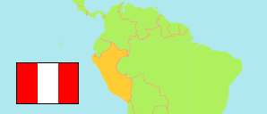
Piura
Region in Peru
Contents: Subdivision
The population development in Piura as well as related information and services (Wikipedia, Google, images).
| Name | Status | Population Census 1993-07-11 | Population Census 2007-10-21 | Population Census 2017-10-22 | Population Projection 2022-06-30 | |
|---|---|---|---|---|---|---|
| Piura | Region | 1,388,264 | 1,676,315 | 1,929,970 | 2,103,099 | |
| Ayabaca | Province | 131,310 | 138,403 | 127,735 | 126,550 | → |
| Huancabamba | Province | 117,459 | 124,298 | 117,747 | 117,899 | → |
| Morropón | Province | 163,052 | 159,693 | 167,461 | 174,921 | → |
| Paita | Province | 76,070 | 108,535 | 136,708 | 154,470 | → |
| Piura | Province | 502,339 | 665,991 | 828,343 | 929,063 | → |
| Sechura | Province | 42,568 | 62,319 | 81,612 | 94,207 | → |
| Sullana | Province | 234,562 | 287,680 | 324,116 | 348,478 | → |
| Talara | Province | 120,904 | 129,396 | 146,248 | 157,511 | → |
| Peru | Republic | 22,639,443 | 27,219,264 | 31,237,385 | 33,396,698 |
Source: Instituto Nacional de Estadística e Informática, Peru (web).
Explanation: The tabulated results of the 2017 census are adjusted for underenumeration. Area figures of provinces are computed by using geospatial data.
Further information about the population structure:
| Gender (C 2017) | |
|---|---|
| Males | 959,571 |
| Females | 970,399 |
| Age Groups (C 2017) | |
|---|---|
| 0-14 years | 578,451 |
| 15-64 years | 1,207,388 |
| 65+ years | 144,131 |
| Age Distribution (C 2017) | |
|---|---|
| 90+ years | 5,047 |
| 80-89 years | 30,304 |
| 70-79 years | 63,305 |
| 60-69 years | 113,140 |
| 50-59 years | 177,280 |
| 40-49 years | 224,312 |
| 30-39 years | 271,726 |
| 20-29 years | 306,711 |
| 10-19 years | 347,882 |
| 0-9 years | 390,263 |
| Urbanization (C 2017) | |
|---|---|
| Rural | 412,833 |
| Urban | 1,517,137 |
| Literacy (A3+) (C 2017) | |
|---|---|
| yes | 1,577,115 |
| no | 244,994 |
| Ethnic Group (A12+) (C 2017) | |
|---|---|
| Quechua | 32,405 |
| Aymara | 1,152 |
| Afro-Peruvian | 129,973 |
| White | 119,566 |
| Mestizo | 1,107,738 |
| Other group | 19,447 |
| Religion (A12+) (C 2017) | |
|---|---|
| Catholic | 1,241,464 |
| Evangelical | 155,970 |
| Other religion | 40,208 |
| No religion | 26,581 |
