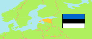
Valga (Estonia)
County
The population development of Valga.
| Name | Status | Population Census 2011-12-31 | Population Census 2021-12-31 | |
|---|---|---|---|---|
| Valga | County | 28,756 | 27,651 | → |
| Eesti [Estonia] | Republic | 1,294,455 | 1,331,824 |
Contents: Settlements
The population development of the settlements in Valga.
| Name | Status | County | Population Census 2011-12-31 | Population Census 2021-12-31 | |
|---|---|---|---|---|---|
| Ala | Built-up Area | Valga | 201 | ... | → |
| Helme | Built-up Area | Valga | ... | 200 | → |
| Hummuli | Built-up Area | Valga | 383 | 335 | → |
| Keeni | Built-up Area | Valga | 231 | 235 | → |
| Linna | Built-up Area | Valga | 355 | 332 | → |
| Lüllemäe | Built-up Area | Valga | 210 | ... | → |
| Õru | Built-up Area | Valga | ... | 209 | → |
| Otepää | Built-up Area | Valga | 2,188 | 1,834 | → |
| Otepää - Pühajärve | Built-up Area | Valga | ... | 271 | → |
| Puka | Built-up Area | Valga | 626 | 587 | → |
| Sangaste - Lauküla | Built-up Area | Valga | 297 | 310 | → |
| Sihva | Built-up Area | Valga | 213 | 237 | → |
| Sooru | Built-up Area | Valga | 218 | ... | → |
| Tõrva | Built-up Area | Valga | 2,843 | 2,786 | → |
| Tsirguliina | Built-up Area | Valga | 446 | 401 | → |
| Valga | Built-up Area | Valga | 12,132 | 11,854 | → |
Source: Statistical Office of Estonia (web).
Explanation: Settlements are defined by built-up areas where the distance between buildings is no more than 200 meters and where live at least 200 persons. Area figures and boundary refer to the 2011 definition.
