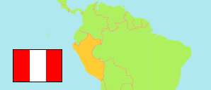
Peru: Ucayali Region
Contents: Provinces and Districts
The population of the provinces and districts (distritos) in the Ucayali Region according to census results and latest official projections.
| Name | Status | Population Census 1993-07-11 | Population Census 2007-10-21 | Population Census 2017-10-22 | Population Projection 2022-06-30 | |
|---|---|---|---|---|---|---|
| Atalaya | Province | 28,290 | 43,933 | 57,591 | 63,844 | → |
| Raimondi | District | 18,341 | 28,348 | 37,782 | 41,621 | → |
| Sepahua | District | 3,698 | 6,670 | 7,841 | 8,510 | → |
| Tahuanía | District | 5,608 | 7,284 | 9,746 | 11,149 | → |
| Yurúa | District | 643 | 1,631 | 2,222 | 2,564 | → |
| Coronel Portillo | Province | 248,449 | 333,890 | 418,055 | 466,369 | → |
| Callería | District | ... | 136,478 | 162,824 | 177,751 | → |
| Campoverde | District | ... | 13,515 | 18,000 | 20,601 | → |
| Iparía | District | 9,278 | 10,774 | 11,909 | 12,605 | → |
| Manantay (← Callería) | District | ... | 70,745 | 97,829 | 113,470 | → |
| Masisea | District | 12,083 | 11,651 | 11,795 | 12,030 | → |
| Nueva Requena (← Campoverde) | District | ... | 5,122 | 5,560 | 5,843 | → |
| Yarinacocha | District | 35,582 | 85,605 | 110,138 | 124,069 | → |
| Padre Abad | Province | 35,539 | 50,590 | 70,006 | 81,541 | → |
| Alexander von Humboldt (← Irázola) | District | ... | ... | 6,085 | 6,380 | → |
| Curimaná (← Padre Abad) | District | ... | 6,047 | 9,158 | 10,946 | → |
| Irázola | District | ... | ... | 10,941 | 12,786 | → |
| Neshuya (← Irázola) | District | ... | ... | 9,003 | 11,236 | → |
| Padre Abad (incl. Huipoca, Boqueron) | District | ... | 25,633 | 34,819 | 40,193 | → |
| Purús | Province | 2,532 | 3,746 | 3,346 | 3,270 | → |
| Purús | District | 2,532 | 3,746 | 3,346 | 3,270 | → |
| Ucayali | Region | 314,810 | 432,159 | 548,998 | 615,024 |
Source: Instituto Nacional de Estadística e Informática, Peru (web).
Explanation: The tabulated results of the 2017 census are adjusted for underenumeration. Area figures are computed by using geospatial data.
Further information about the population structure:
| Gender (C 2017) | |
|---|---|
| Males | 279,401 |
| Females | 269,597 |
| Age Groups (C 2017) | |
|---|---|
| 0-14 years | 191,231 |
| 15-64 years | 330,497 |
| 65+ years | 27,270 |
| Age Distribution (C 2017) | |
|---|---|
| 90+ years | 704 |
| 80-89 years | 4,205 |
| 70-79 years | 11,595 |
| 60-69 years | 25,622 |
| 50-59 years | 43,255 |
| 40-49 years | 58,941 |
| 30-39 years | 78,236 |
| 20-29 years | 90,959 |
| 10-19 years | 103,811 |
| 0-9 years | 131,670 |
| Urbanization (C 2017) | |
|---|---|
| Rural | 107,677 |
| Urban | 441,321 |
| Literacy (A3+) (C 2017) | |
|---|---|
| yes | 441,932 |
| no | 70,147 |
| Ethnic Group (A12+) (C 2017) | |
|---|---|
| Quechua | 20,141 |
| Aymara | 632 |
| Afro-Peruvian | 8,307 |
| White | 9,105 |
| Mestizo | 293,881 |
| Other group | 43,737 |
| Religion (A12+) (C 2017) | |
|---|---|
| Catholics | 226,512 |
| Evangelicals | 108,795 |
| Other religion | 20,537 |
| No religion | 36,629 |
