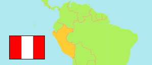
Manantay
District in Ucayali Region
Contents: Population
The population development of Manantay as well as related information and services (Wikipedia, Google, images).
| Name | Status | Population Census 1993-07-11 | Population Census 2007-10-21 | Population Census 2017-10-22 | Population Projection 2022-06-30 | |
|---|---|---|---|---|---|---|
| Manantay (← Callería) | District | ... | 70,745 | 97,829 | 113,470 | |
| Ucayali | Region | 314,810 | 432,159 | 548,998 | 615,024 |
Source: Instituto Nacional de Estadística e Informática, Peru (web).
Explanation: The tabulated results of the 2017 census are adjusted for underenumeration. Area figures are computed by using geospatial data.
Further information about the population structure:
| Gender (C 2017) | |
|---|---|
| Males | 48,931 |
| Females | 48,898 |
| Age Groups (C 2017) | |
|---|---|
| 0-14 years | 35,642 |
| 15-64 years | 57,701 |
| 65+ years | 4,486 |
| Age Distribution (C 2017) | |
|---|---|
| 90+ years | 112 |
| 80-89 years | 665 |
| 70-79 years | 1,961 |
| 60-69 years | 4,100 |
| 50-59 years | 7,105 |
| 40-49 years | 10,070 |
| 30-39 years | 13,484 |
| 20-29 years | 16,479 |
| 10-19 years | 19,383 |
| 0-9 years | 24,470 |
| Urbanization (C 2017) | |
|---|---|
| Rural | 2,185 |
| Urban | 95,644 |
| Literacy (A3+) (C 2017) | |
|---|---|
| yes | 79,827 |
| no | 11,075 |
| Ethnic Group (A12+) (C 2017) | |
|---|---|
| Quechua | 2,057 |
| Aymara | 156 |
| Afro-Peruvian | 1,944 |
| White | 1,789 |
| Mestizo | 59,536 |
| Other group | 847 |
| Religion (A12+) (C 2017) | |
|---|---|
| Catholic | 42,326 |
| Evangelical | 18,049 |
| Other religion | 3,277 |
| No religion | 5,023 |