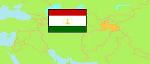
Farchor
District in Tajikistan
Contents: Population
The population development of Farchor as well as related information and services (Wikipedia, Google, images).
| Name | Status | Native | Population Census 1979-01-12 | Population Census 1989-01-12 | Population Census 2000-01-20 | Population Census 2010-09-21 | Population Census 2020-10-01 | Population Estimate 2024-01-01 | |
|---|---|---|---|---|---|---|---|---|---|
| Farchor [Farkhor] | District | Фархор | 60,880 | 85,453 | 111,714 | 137,392 | 174,630 | 187,800 | |
| Toçikiston [Tajikistan] | Republic | Тоҷикистон | 3,801,357 | 5,108,576 | 6,127,493 | 7,564,502 | 9,657,005 | 10,288,300 |
Source: State Statistical Committee of the Republic of Tajikistan.
Explanation: In 2020, Dushanbe city was expanded by areas of Rūdakī district with about 77 km² and 230,000 inhabitants. The figures before 2020 do not take this change into account.
Further information about the population structure:
| Gender (C 2020) | |
|---|---|
| Males | 88,735 |
| Females | 85,895 |
| Urbanization (E 2024) | |
|---|---|
| Rural | 158,900 |
| Urban | 28,900 |