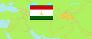
Chatlon
Province in Tajikistan
Contents: Subdivision
The population development in Chatlon as well as related information and services (Wikipedia, Google, images).
| Name | Status | Native | Population Census 1979-01-12 | Population Census 1989-01-12 | Population Census 2000-01-20 | Population Census 2010-09-21 | Population Census 2020-10-01 | Population Estimate 2022-01-01 | |
|---|---|---|---|---|---|---|---|---|---|
| Chatlon [Khatlon] | Province | Хатлон | 1,220,949 | 1,701,380 | 2,150,136 | 2,677,251 | 3,436,420 | 3,530,000 | |
| Abdurah̦moni Çomī [Dzhami] | District | Абдураҳмони Ҷомӣ | 92,255 | 85,109 | 106,358 | 135,489 | 178,671 | 183,900 | → |
| Balçuvon [Baljuvon] | District | Балҷувон | ... | ... | 20,584 | 24,450 | 31,735 | 32,700 | → |
| Çajh̦un [Ḳumsangir, Jayhun] | District | Ҷайҳун | 61,582 | 74,774 | 84,926 | 110,429 | 141,651 | 145,600 | → |
| Çaloliddin Balchī [Rumī, Jalaladdin Balkhi] | District | Ҷалолиддин Балхӣ | 110,926 | 107,363 | 126,268 | 157,745 | 204,895 | 210,500 | → |
| Chovaling [Khovaling] | District | Ховалинг | ... | 34,183 | 37,247 | 48,825 | 56,827 | 58,300 | → |
| Churoson [Khuroson] | District | Хуросон | ... | 51,916 | 71,690 | 91,948 | 122,672 | 126,300 | → |
| Danġara [Danghara] | District | Данғара | 50,495 | 73,165 | 96,384 | 122,498 | 165,270 | 171,900 | → |
| Dūstī [Çilikūl] | District | Дӯстӣ | ... | 65,238 | 73,176 | 90,057 | 117,665 | 122,000 | → |
| Ëvon [Yovon] | District | Ёвон | 69,965 | 103,629 | 134,585 | 178,801 | 241,009 | 248,100 | → |
| Farchor [Farkhor] | District | Фархор | 60,880 | 85,453 | 111,714 | 137,392 | 174,630 | 179,100 | → |
| Ḳubodjën [Qabodiyon] | District | Қубодиён | 67,703 | 93,346 | 119,318 | 148,262 | 190,048 | 195,100 | → |
| Kūlob | City | Кӯлоб | 94,351 | 129,612 | 149,051 | 181,317 | 216,830 | 222,100 | → |
| Kūšonijën [Kushoniyon; incl. Bochtar] | District | Кӯшониён | 138,112 | 215,852 | 234,827 | 293,113 | 378,609 | 387,200 | → |
| Levakant [Sarband] | City | Левакант | ... | ... | 29,273 | 38,875 | 48,441 | 49,700 | → |
| Mir Sajid Alii H̦amadonī [Hamadoni] | District | Мир Сайид Алии Ҳамадонӣ | 68,092 | 95,235 | 105,829 | 123,941 | 151,346 | 154,300 | → |
| Mūminobod | District | Мӯминобод | 36,769 | 53,906 | 63,589 | 77,664 | 96,881 | 99,300 | → |
| Norak | City | Норак | 27,933 | 33,454 | 40,461 | 49,049 | 63,429 | 64,900 | → |
| Nosiri Chusrav [Nosiri Khusrav] | District | Носири Хусрав | ... | ... | 21,996 | 30,321 | 43,697 | 45,100 | → |
| Panç [Panj] | District | Панҷ | 49,580 | 66,997 | 79,114 | 93,744 | 121,058 | 124,100 | → |
| Šah̦ritus [Shahritus] | District | Шаҳритус | 53,446 | 80,334 | 81,497 | 101,897 | 131,724 | 135,700 | → |
| Šamsiddin Šoh̦in [Šūroobod, Shamsiddin Shohin] | District | Шамсиддин Шоҳин | ... | ... | 38,925 | 45,661 | 56,465 | 57,700 | → |
| Temurmalik | District | Темурмалик | 28,486 | 39,391 | 49,096 | 58,693 | 73,527 | 75,300 | → |
| Vachš [Vakhsh] | District | Вахш | 109,047 | 102,006 | 125,583 | 159,511 | 206,871 | 213,000 | → |
| Vose' | District | Восеъ | 101,327 | 110,417 | 148,645 | 177,569 | 222,469 | 228,200 | → |
| Toçikiston [Tajikistan] | Republic | Тоҷикистон | 3,801,357 | 5,108,576 | 6,127,493 | 7,564,502 | 9,657,005 | 9,886,800 |
Source: State Statistical Committee of the Republic of Tajikistan.
Explanation: In 2020, Dushanbe city was expanded by areas of Rūdakī district with about 77 km² and 230,000 inhabitants. The figures before 2020 do not take this change into account.
