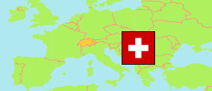
Bezirk Solothurn
District in Solothurn
District
The population development of Bezirk Solothurn.
| Name | Status | Population Census 1980-12-02 | Population Census 1990-12-04 | Population Census 2000-12-05 | Population Estimate 2010-12-31 | Population Estimate 2020-12-31 | Population Estimate 2024-12-31 | |
|---|---|---|---|---|---|---|---|---|
| Bezirk Solothurn | District | 15,778 | 15,748 | 15,489 | 16,066 | 16,802 | 16,847 | → |
| Solothurn | Canton | 218,102 | 231,746 | 244,341 | 255,284 | 277,462 | 289,792 |
Contents: Cities and Communes
The population development of the cities and communes in Bezirk Solothurn.
| Name | Status | District | Population Census 1980-12-02 | Population Census 1990-12-04 | Population Census 2000-12-05 | Population Estimate 2010-12-31 | Population Estimate 2020-12-31 | Population Estimate 2024-12-31 | |
|---|---|---|---|---|---|---|---|---|---|
| Solothurn | City | Bezirk Solothurn | 15,778 | 15,748 | 15,489 | 16,066 | 16,802 | 16,847 | → |
Source: Swiss Federal Statistical Office.
Explanation: Districts and communes in the boundaries of December 2024. The population figures for 2024 are final.