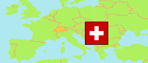
Switzerland: Nidwalden
Contents: Nidwalden
Canton
43,520 Population [2020] – estimate
45,345 Population [2024] – estimate
276.0km² Area
164.3/km² Density [2024]
Canton
The population development of the Canton of Nidwald (Nidwalden) according to census results and latest official estimates.
| Name | Status | Population Census 1980-12-02 | Population Census 1990-12-04 | Population Census 2000-12-05 | Population Estimate 2010-12-31 | Population Estimate 2020-12-31 | Population Estimate 2024-12-31 | |
|---|---|---|---|---|---|---|---|---|
| Nidwalden [Nidwald] | Canton | 28,617 | 33,044 | 37,235 | 41,024 | 43,520 | 45,345 |
Contents: Cities and Communes
The population of all cities and communes in the Canton of Nidwald (Nidwalden) according to census results and latest official estimates.
| Name | Status | Population Census 1980-12-02 | Population Census 1990-12-04 | Population Census 2000-12-05 | Population Estimate 2010-12-31 | Population Estimate 2020-12-31 | Population Estimate 2024-12-31 | |
|---|---|---|---|---|---|---|---|---|
| Beckenried | Commune | 2,120 | 2,418 | 2,825 | 3,316 | 3,742 | 3,712 | → |
| Buochs | Commune | 3,742 | 4,295 | 4,856 | 5,318 | 5,313 | 5,483 | → |
| Dallenwil | Commune | 1,142 | 1,464 | 1,649 | 1,791 | 1,848 | 1,871 | → |
| Emmetten | Commune | 715 | 970 | 1,184 | 1,246 | 1,541 | 1,668 | → |
| Ennetbürgen | Commune | 2,716 | 3,448 | 3,939 | 4,333 | 4,866 | 5,327 | → |
| Ennetmoos | Commune | 1,347 | 1,729 | 1,875 | 2,080 | 2,254 | 2,338 | → |
| Hergiswil (NW) | Commune | 4,254 | 4,431 | 4,754 | 5,468 | 5,863 | 6,296 | → |
| Oberdorf (NW) | Commune | 2,272 | 2,601 | 2,872 | 3,061 | 3,080 | 3,099 | → |
| Stans | Commune | 5,681 | 6,217 | 6,983 | 7,961 | 8,171 | 8,508 | → |
| Stansstad | Commune | 3,104 | 3,785 | 4,325 | 4,445 | 4,727 | 4,922 | → |
| Wolfenschiessen | Commune | 1,524 | 1,686 | 1,973 | 2,005 | 2,115 | 2,121 | → |
Source: Swiss Federal Statistical Office.
Explanation: Districts and communes in the boundaries of December 2024. The population figures for 2024 are final.