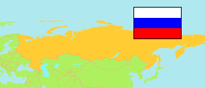
Šatura
Urban District in Moscow Oblast
Urban District
The population development of Šatura.
| Name | Native | Status | Population Census 2002-10-09 | Population Census 2010-10-14 | Population Census 2021-10-01 | |
|---|---|---|---|---|---|---|
| Šatura [Shatura] | Городской округ Шатура | Urban District | 93,374 | 93,359 | 103,822 | → |
| Moskva Oblast [Moscow] | Московская область | Region | 6,618,538 | 6,860,074 | 8,524,665 |
Contents: Urban and Rural Places
The population development of the urban and rural places in Šatura.
| Name | Native | Status | District | Population Census 2002-10-09 | Population Census 2010-10-14 | Population Census 2021-10-01 | |
|---|---|---|---|---|---|---|---|
| Central'noj Usad'by Sovchoza «Mir» [Tsentralnoy Usadby Sovkhoza »Mir«] | Центральной усадьбы совхоза «Мир» | Rural Settlement | Šatura | 3,031 | 2,955 | 3,131 | → |
| Čerusti [Cherusti] | Черусти | Urban Settlement | Šatura | 2,891 | 2,862 | 3,600 | → |
| Mišeronskij [Misheronsky] | Мишеронский | Urban Settlement | Šatura | 3,821 | 3,857 | 4,697 | → |
| Rošal' [Roshal] | Рошаль | City | Šatura | 22,407 | 21,272 | 21,401 | → |
| Šatura [Shatura] | Шатура | City | Šatura | 30,393 | 32,885 | 38,230 | → |
| Šaturtorf [Shaturtorf] | Шатурторф | Rural Settlement | Šatura | 3,340 | 3,572 | 4,228 | → |
Source: Federal State Statistics Service Russia (web), pop-stat.mashke.org.