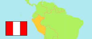
Virú
Province in La Libertad Region
Contents: Subdivision
The population development in Virú as well as related information and services (Wikipedia, Google, images).
| Name | Status | Population Census 1993-07-11 | Population Census 2007-10-21 | Population Census 2017-10-22 | Population Projection 2022-06-30 | |
|---|---|---|---|---|---|---|
| Virú | Province | 34,674 | 76,710 | 96,691 | 109,660 | |
| Chao (← Virú) | District | ... | 22,826 | 34,425 | 41,760 | → |
| Guadalupito (← Virú) | District | ... | 6,232 | 7,207 | 7,882 | → |
| Virú | District | ... | 47,652 | 55,059 | 60,018 | → |
| La Libertad | Region | 1,270,261 | 1,617,050 | 1,888,972 | 2,077,345 |
Source: Instituto Nacional de Estadística e Informática, Peru (web).
Explanation: The tabulated results of the 2017 census are adjusted for underenumeration. Area figures are computed by using geospatial data.
Further information about the population structure:
| Gender (C 2017) | |
|---|---|
| Males | 48,492 |
| Females | 48,199 |
| Age Groups (C 2017) | |
|---|---|
| 0-14 years | 31,275 |
| 15-64 years | 60,505 |
| 65+ years | 4,911 |
| Age Distribution (C 2017) | |
|---|---|
| 90+ years | 148 |
| 80-89 years | 905 |
| 70-79 years | 2,144 |
| 60-69 years | 4,006 |
| 50-59 years | 6,728 |
| 40-49 years | 9,986 |
| 30-39 years | 14,712 |
| 20-29 years | 18,478 |
| 10-19 years | 17,947 |
| 0-9 years | 21,637 |
| Urbanization (C 2017) | |
|---|---|
| Rural | 17,224 |
| Urban | 79,467 |
| Literacy (A3+) (C 2017) | |
|---|---|
| yes | 77,219 |
| no | 13,140 |
| Ethnic Group (A12+) (C 2017) | |
|---|---|
| Quechua | 2,217 |
| Aymara | 58 |
| Afro-Peruvian | 9,698 |
| White | 7,898 |
| Mestizo | 48,565 |
| Other group | 1,034 |
| Religion (A12+) (C 2017) | |
|---|---|
| Catholic | 40,817 |
| Evangelical | 19,796 |
| Other religion | 1,592 |
| No religion | 8,767 |