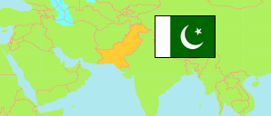
Malakand Protected Area
District in Khyber Pakhtunkhwa
District
The population development of Malakand Protected Area.
| Name | Status | Population Census 1972-09-16 | Population Census 1981-03-01 | Population Census 1998-03-01 | Population Census 2017-03-15 | |
|---|---|---|---|---|---|---|
| Malakand Protected Area | District | 185,872 | 257,797 | 452,291 | 717,806 | → |
| Khyber Pakhtunkhwa (North-West Frontier) [incl. FATA] | Province | 10,879,781 | 13,259,875 | 20,919,976 | 35,501,964 |
Contents: Urban Localities
The population development of the urban localities in Malakand Protected Area.
| Name | Status | District | Population Census 1972-09-16 | Population Census 1981-03-01 | Population Census 1998-03-01 | Population Census 2017-03-15 | |
|---|---|---|---|---|---|---|---|
| Bat Khela | Municipal Council | Malakand Protected Area | 14,945 | ... | 43,179 | 67,686 | → |
Source: Pakistan Bureau of Statistics.
Explanation: The results of the 2017 census are final. Districts in 2023 boundaries.