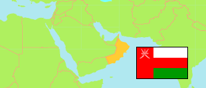
Manaḥ
District in Ad Dakhiliyah Governorate
District
The population development of Manaḥ.
| Name | Native | Status | Population Census 2003-12-07 | Population Census 2010-12-12 | Population Census 2020-12-12 | |
|---|---|---|---|---|---|---|
| Manaḥ | منح | District | 12,568 | 15,056 | 25,320 | → |
| Ad-Dākhilīyah [Ad Dakhiliyah] | الداخلية | Governorate | 267,140 | 326,651 | 478,501 |
Contents: Localities
The population development of the localities in Manaḥ.
| Name | Native | Status | District | Population Census 2003-12-07 | Population Census 2010-12-12 | Population Census 2020-12-12 | |
|---|---|---|---|---|---|---|---|
| Abu Nikhaylah | ابو نخيلة | Locality | Manaḥ | ... | 18 | 70 | → |
| Al-Abyad | الابيض | Locality | Manaḥ | 48 | 45 | 135 | → |
| Al-Mahyul | المحيول | Locality | Manaḥ | 787 | 980 | 1,520 | → |
| Al-Mara | المعرى | Locality | Manaḥ | 1,400 | 1,668 | 2,429 | → |
| Izz | عز | Locality | Manaḥ | 1,434 | 1,596 | 3,595 | → |
| Mamad | معمد | Locality | Manaḥ | 1,644 | 2,024 | 3,120 | → |
| Manah | منح | Locality | Manaḥ | 6,153 | 7,749 | 12,553 | → |
| Mitan | متان | Locality | Manaḥ | 654 | 395 | 719 | → |
| Musaydrah | مصيدرة | Locality | Manaḥ | 39 | 384 | 704 | → |
| Sayh al-Barakat | سيح البركات | Locality | Manaḥ | ... | 12 | 170 | → |
| Shibat al-Mashyah | شعبة المشية | Locality | Manaḥ | 109 | 185 | 259 | → |
Source: Sultanate of Oman, National Centre for Statistics and Information (web).
Explanation: The 2020 census was organized as an electronic census.