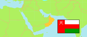
Al-'Awābī
District in Al Batinah South Governorate
District
The population development of Al-'Awābī.
| Name | Native | Status | Population Census 2003-12-07 | Population Census 2010-12-12 | Population Census 2020-12-12 | |
|---|---|---|---|---|---|---|
| Al-'Awābī | العوابي | District | 10,469 | 13,326 | 18,802 | → |
| Janūb al-Bāṭinah [Al Batinah South] | جنوب الباطنة | Governorate | 244,542 | 289,008 | 465,550 |
Contents: Localities
The population development of the localities in Al-'Awābī.
| Name | Native | Status | District | Population Census 2003-12-07 | Population Census 2010-12-12 | Population Census 2020-12-12 | |
|---|---|---|---|---|---|---|---|
| Adh-Dhahir | الظاهر | Locality | Al-'Awābī | 222 | 419 | 681 | → |
| Adh-Dhahrah | الظهرة | Locality | Al-'Awābī | 380 | 427 | 600 | → |
| Al-Alya | العلياء | Locality | Al-'Awābī | 546 | 534 | 654 | → |
| Al-Awabi | العوابي | Locality | Al-'Awābī | 4,231 | 5,600 | 10,929 | → |
| Al-Hawdniyah | الهودنية | Locality | Al-'Awābī | 40 | 117 | 179 | → |
| Al-Hijar | الهجار | Locality | Al-'Awābī | 273 | 247 | 348 | → |
| Al-Hijayr | الهجير | Locality | Al-'Awābī | 65 | 56 | 68 | → |
| Al-Mahduth | المحدوث | Locality | Al-'Awābī | 129 | 142 | 423 | → |
| Al-Mahsanah | المحصنة | Locality | Al-'Awābī | 212 | 176 | 161 | → |
| Al-Mandhur | المنظور | Locality | Al-'Awābī | 42 | 45 | 50 | → |
| Al-Markh | المرخ | Locality | Al-'Awābī | 82 | 96 | 115 | → |
| Al-Wilayja | الوليجاء | Locality | Al-'Awābī | 65 | 71 | 64 | → |
| Ar-Rajmah | الرجمة | Locality | Al-'Awābī | 37 | 44 | 85 | → |
| Ar-Rami | الرامي | Locality | Al-'Awābī | 968 | 1,007 | 1,074 | → |
| As-Sahal | السهل | Locality | Al-'Awābī | 62 | 71 | 58 | → |
| As-Sibaykha | الصبيخاء | Locality | Al-'Awābī | 469 | 432 | 395 | → |
| Dakum | دكم | Locality | Al-'Awābī | 170 | 164 | 174 | → |
| Hadas | حدس | Locality | Al-'Awābī | 91 | 49 | 53 | → |
| Misfat al-Hatatlah | مسفاة الهطاطلة | Locality | Al-'Awābī | 111 | 90 | 129 | → |
| Misfat ash-Shirayqiyin | مسفاة الشريقين | Locality | Al-'Awābī | 199 | 216 | 274 | → |
| Shuh | شوة | Locality | Al-'Awābī | 64 | 71 | 92 | → |
| Sital | ستال | Locality | Al-'Awābī | 953 | 2,050 | 1,079 | → |
| Sunaybu | صنيبع | Locality | Al-'Awābī | 251 | 273 | 266 | → |
| Tawi as-Sayh | طوي السيح | Locality | Al-'Awābī | 230 | 84 | 154 | → |
| Thaqub | ثقب | Locality | Al-'Awābī | 157 | 159 | 182 | → |
| Wadi Sufun | وادي صفون | Locality | Al-'Awābī | 43 | 41 | 50 | → |
Source: Sultanate of Oman, National Centre for Statistics and Information (web).
Explanation: The 2020 census was organized as an electronic census.