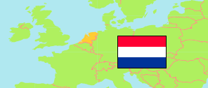
Maarssen
Municipal District in Randstad East Conurbation
Contents: Subdivision
The population in Maarssen as well as related information and services (Wikipedia, Google, images).
| Name | Status | Population Estimate 2022-01-01 | |
|---|---|---|---|
| Maarssen | Municipal District | 15,880 | |
| Begraafplaats Maarssen | Neighborhood | 5 | → |
| Bethunepolder-zuid | Neighborhood | 180 | → |
| Centrum ten noorden van de Vecht | Neighborhood | 350 | → |
| Centrum ten zuiden van de Vecht | Neighborhood | 955 | → |
| Componistenbuurt | Neighborhood | 905 | → |
| Friezenbuurt | Neighborhood | 480 | → |
| Hogebrug | Neighborhood | 760 | → |
| Lanenkwartier | Neighborhood | 965 | → |
| Maarsseveen | Neighborhood | 630 | → |
| Omgeving Goudestein | Neighborhood | 105 | → |
| Op Buuren | Neighborhood | 1,475 | → |
| Otterspoorbroek | Neighborhood | 170 | → |
| Park Vechtenstein | Neighborhood | 10 | → |
| Reizende man | Neighborhood | 710 | → |
| Schilderskwartier | Neighborhood | 1,650 | → |
| Staatsliedenbuurt | Neighborhood | 1,730 | → |
| Zandweg-Oostwaard | Neighborhood | 3,250 | → |
| Zeeheldenbuurt | Neighborhood | 930 | → |
| Zogwetering | Neighborhood | 625 | → |
| Randstad Oost (Utrecht - Amersfoort - Hilversum) [Randstad East] | Conurbation | 1,282,780 |
Source: Statistics Netherlands (web).
Explanation: Composition by »City Population«.