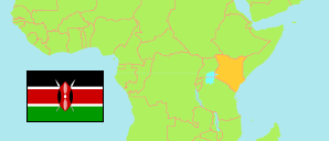
Machakos
County in Kenya
Contents: Subdivision
The population development in Machakos as well as related information and services (Wikipedia, Google, images).
| Name | Status | Population Census 2009-08-24 | Population Census 2019-08-24 | |
|---|---|---|---|---|
| Machakos | County | 1,098,584 | 1,421,932 | |
| Athi River | Subcounty | 139,502 | 322,499 | → |
| Kalama | Subcounty | 56,640 | 54,462 | → |
| Kangundo | Subcounty | 94,367 | 97,917 | → |
| Kathiani | Subcounty | 104,217 | 111,890 | → |
| Machakos | Subcounty | 142,571 | 170,606 | → |
| Masinga | Subcounty | 125,940 | 148,522 | → |
| Matungulu | Subcounty | 124,736 | 161,557 | → |
| Mwala | Subcounty | 163,032 | 181,896 | → |
| Yatta | Subcounty | 147,579 | 172,583 | → |
| Kenya | Republic | 38,610,097 | 47,564,296 |
Source: Kenya National Bureau of Statistics.
Further information about the population structure:
| Gender (C 2019) | |
|---|---|
| Males | 710,707 |
| Females | 711,191 |
| Intersex | 34 |
| Age Groups (C 2019) | |
|---|---|
| 0-14 years | 463,633 |
| 15-64 years | 878,729 |
| 65+ years | 79,518 |
| Age Distribution (C 2019) | |
|---|---|
| 90+ years | 6,382 |
| 80-89 years | 14,002 |
| 70-79 years | 31,053 |
| 60-69 years | 64,807 |
| 50-59 years | 90,092 |
| 40-49 years | 146,601 |
| 30-39 years | 210,012 |
| 20-29 years | 248,178 |
| 10-19 years | 313,335 |
| 0-9 years | 297,418 |