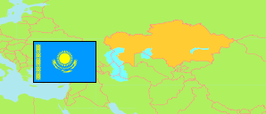
Mańǵystaý
Region in Kazakhstan
Contents: Subdivision
The population development in Mańǵystaý as well as related information and services (Wikipedia, Google, images).
| Name | Status | Native | Population Census 1999-02-14 | Population Census 2009-02-25 | Population Census 2021-10-01 | Population Estimate 2023-01-01 | |
|---|---|---|---|---|---|---|---|
| Mańǵystaý [Mangystau] | Region | Маңғыстау | 314,669 | 485,392 | 735,008 | 767,107 | |
| Aqtaý [Aktau] | City with Environs | Ақтау Қ.Ә. | 144,798 | 169,809 | 259,365 | 271,731 | → |
| Beıneý aýdany [Beyneu] | District | Бейнеу ауданы | 26,548 | 46,937 | 70,585 | 72,478 | → |
| Jańaózen [Zhanaozen] | City with Environs | Жаңаөзен Қ.Ә. | 63,337 | 113,014 | 142,458 | 147,941 | → |
| Mańǵystaý aýdany [Mangystau] | District | Маңғыстау ауданы | 29,024 | 31,215 | 35,052 | 35,342 | → |
| Munaıly aýdany [Munaily] | District | Мұнайлы ауданы | 13,300 | 74,294 | 153,838 | 163,831 | → |
| Qaraqıja aýdany [Karakiya] | District | Қарақия ауданы | 23,437 | 29,579 | 36,460 | 36,742 | → |
| Túpqaraǵan aýdany [Tupkaragan] | District | Түпқараған ауданы | 14,225 | 20,544 | 37,250 | 39,042 | → |
| Qazaqstan [Kazakhstan] | Republic | Қазақстан | 14,981,281 | 16,009,597 | 19,186,015 | 19,766,807 |
Source: The Agency of Statistics of the Republic of Kazakhstan.
Explanation: Area and density figures of districts are computed using geospatial data. Transliteration according to the Presidential Decree of 19 February 2018.
