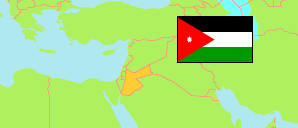
Al-Qaṣr
District in Karak Governorate
District
The population development of Al-Qaṣr.
| Name | Native | Status | Population Census 1994-12-10 | Population Census 2004-10-02 | Population Census 2015-11-30 | |
|---|---|---|---|---|---|---|
| Al-Qaṣr [Qasr] | القصر | District | 16,587 | 20,860 | 29,407 | → |
| Al-Karak [Karak] | الكرك | Governorate | 169,770 | 204,185 | 316,629 |
Contents: Localities
The population development of the localities in Al-Qaṣr.
| Name | Native | Status | District | Population Census 1994-12-10 | Population Census 2004-10-02 | Population Census 2015-11-30 | |
|---|---|---|---|---|---|---|---|
| Abū Trābah [Abu Trabah] | ابو ترابه | Rural Locality | Al-Qaṣr | 359 | ... | 292 | → |
| Al-'Ālyah [Alyeh] | العاليه | Rural Locality | Al-Qaṣr | 443 | ... | 749 | → |
| Al-Jad'ā [Jada'] | الجدعا | Rural Locality | Al-Qaṣr | 2,000 | ... | 3,865 | → |
| Al-Mawjib [Mowjeb] | الموجب | Rural Locality | Al-Qaṣr | 646 | ... | 65 | → |
| Al-Qaṣr [Qasr] | القصر | Urban Locality | Al-Qaṣr | 3,144 | ... | 6,127 | → |
| Al-Yārūt [Yaroot] | الياروت | Rural Locality | Al-Qaṣr | 1,168 | ... | 2,126 | → |
| Ar-Rabbah [Rabbah] | الربه | Urban Locality | Al-Qaṣr | 3,463 | ... | 7,208 | → |
| Ar-Rashāīdah [Rashadeih] | الرشايده | Rural Locality | Al-Qaṣr | 181 | ... | 173 | → |
| Ar-Rawḍah [Rawdah] | الروضه | Rural Locality | Al-Qaṣr | ... | ... | 986 | → |
| As-Smākiyah [Smakiyyeh] | السماكيه | Rural Locality | Al-Qaṣr | 1,438 | ... | 1,372 | → |
| Damnah [Demnah] | دمنه | Rural Locality | Al-Qaṣr | 879 | ... | 2,616 | → |
| Ḥammūd [Hmood] | حمود | Rural Locality | Al-Qaṣr | 397 | ... | 284 | → |
| Mis'ar [Mes'ar] | مسعر | Rural Locality | Al-Qaṣr | 419 | ... | 626 | → |
| Mughayyir [Mghayyer] | مغير | Rural Locality | Al-Qaṣr | 765 | ... | 1,522 | → |
| Rīḥā [Riha] | ريحا | Rural Locality | Al-Qaṣr | ... | ... | 741 | → |
| Shīḥān [Sheehan] | شيحان | Rural Locality | Al-Qaṣr | 499 | ... | 655 | → |
Source: Department of Statistics, Jordan (web).
Explanation: Area and density figures are computed using geospatial data.