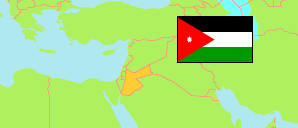
Al-Wasṭīyah
District in Governorate Irbid
District
The population development of Al-Wasṭīyah .
| Name | Native | Status | Population Census 1994-12-10 | Population Census 2004-10-02 | Population Census 2015-11-30 | |
|---|---|---|---|---|---|---|
| Al-Wasṭīyah [Wastiyyah] | الوسطية | District | ... | 24,046 | 42,571 | → |
| Irbid | إربد | Governorate | 751,634 | 928,292 | 1,770,158 |
Contents: Localities
The population development of the localities in Al-Wasṭīyah .
| Name | Native | Status | District | Population Census 1994-12-10 | Population Census 2004-10-02 | Population Census 2015-11-30 | |
|---|---|---|---|---|---|---|---|
| Al-Kharāj [Kharaj] | الخراج | Rural Locality | Al-Wasṭīyah | 1,741 | ... | 3,907 | → |
| Ḥūafā al-Wasṭiyah [Hoafa El-Wastiyyeh] | حوفا الوسطية | Urban Locality | Al-Wasṭīyah | 2,843 | ... | 7,084 | → |
| Kafr 'Ān [Kfar An] | كفر عان | Rural Locality | Al-Wasṭīyah | 2,059 | ... | 4,077 | → |
| Kafr Asad [Kfar Asad] | كفر اسد | Urban Locality | Al-Wasṭīyah | 6,545 | 8,063 | 14,232 | → |
| Qam | قم | Rural Locality | Al-Wasṭīyah | 986 | ... | 2,274 | → |
| Qumaym [Qmaim] | قميم | Urban Locality | Al-Wasṭīyah | 4,078 | 5,108 | 8,695 | → |
| Ṣaydūr [Saidoor] | صيدور | Rural Locality | Al-Wasṭīyah | 1,100 | ... | 2,302 | → |
Source: Department of Statistics, Jordan (web).
Explanation: Area and density figures are computed using geospatial data.