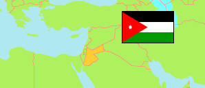
Ar-Ramthā
District in Governorate Irbid
District
The population development of Ar-Ramthā.
| Name | Native | Status | Population Census 1994-12-10 | Population Census 2004-10-02 | Population Census 2015-11-30 | |
|---|---|---|---|---|---|---|
| Ar-Ramthā [Ramtha] | الرمثا | District | 79,304 | 109,142 | 238,502 | → |
| Irbid | إربد | Governorate | 751,634 | 928,292 | 1,770,158 |
Contents: Localities
The population development of the localities in Ar-Ramthā.
| Name | Native | Status | District | Population Census 1994-12-10 | Population Census 2004-10-02 | Population Census 2015-11-30 | |
|---|---|---|---|---|---|---|---|
| Adh-Dhunaybah [Dnaibeh] | الذنيبة | Rural Locality | Ar-Ramthā | 1,762 | ... | 3,798 | → |
| Al-Buwayḍah [Bwaidhah] | البويضة | Urban Locality | Ar-Ramthā | 3,931 | 5,451 | 10,815 | → |
| 'Amrāwah [Emrawah] | عمراوة | Urban Locality | Ar-Ramthā | 2,955 | ... | 7,158 | → |
| Ar-Ramthā [Ramtha] | الرمثا | Urban Locality | Ar-Ramthā | 50,022 | 71,433 | 155,693 | → |
| Ash-Shajarah | الشجرة | Urban Locality | Ar-Ramthā | 8,970 | 11,523 | 27,902 | → |
| Aṭ-Ṭurrah [Torrah] | الطرة | Urban Locality | Ar-Ramthā | 11,664 | 14,844 | 33,136 | → |
Source: Department of Statistics, Jordan (web).
Explanation: Area and density figures are computed using geospatial data.