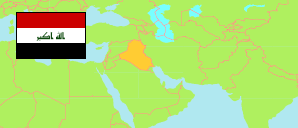
Al-Anbār
Governorate in Iraq
Contents: Subdivision
The population development in Al-Anbār as well as related information and services (Wikipedia, Google, images).
| Name | Status | Native | Population Estimate 2009-10-17 | Population Estimate 2018-07-01 | |
|---|---|---|---|---|---|
| Al-Anbār | Governorate | الانبار | 1,483,359 | 1,771,656 | |
| Al-'Āmiriyah | Central Subdistrict | العامریة | 89,704 | 105,336 | → |
| Al-Baghdādī | Subdistrict | البغدادي | 31,177 | 36,529 | → |
| Al-Fallūjah [Fallujah] | Central Subdistrict | الفلوجة | 275,128 | 333,880 | → |
| Al-Furāt | Subdistrict | الفرات | 26,036 | 30,347 | → |
| Al-Ḥabbāniyah | Subdistrict | الحبانیة | 118,131 | 138,754 | → |
| Al-Ḥaqlāniyah | Subdistrict | الحقلانیة | 23,314 | 27,857 | → |
| Al-Karmah | Subdistrict | الكرمة | 116,197 | 135,262 | → |
| Al-Qā'im | Central Subdistrict | القائم | 90,400 | 109,192 | → |
| Al-'Ubaydī | Subdistrict | العبیدي | 25,718 | 29,915 | → |
| Al-'Ubūr / Ar-Rumānah | Subdistrict | العبور / الرمانة | 34,028 | 40,085 | → |
| Al-Wafā' | Subdistrict | الوفاء | 8,728 | 10,429 | → |
| Al-Walīd | Subdistrict | الولید | 5,130 | 5,958 | → |
| 'Anah | Central Subdistrict | عنھ | 26,162 | 31,575 | → |
| An-Nukhayb | Subdistrict | النخیب | 2,972 | 3,571 | → |
| Ar-Ramādī [Ramadi] | Central Subdistrict | الرمادي | 364,841 | 436,090 | → |
| Ar-Ruṭbah | Central Subdistrict | الرطبة | 30,898 | 37,511 | → |
| Aṣ-Ṣaqlāwiyah | Subdistrict | الصقلاویة | 45,832 | 53,653 | → |
| Barwānah | Subdistrict | بروانة | 21,674 | 26,117 | → |
| Ḥadīṭha | Central Subdistrict | حدیثة | 42,231 | 51,736 | → |
| Hīt | Central Subdistrict | ھیت | 70,125 | 85,265 | → |
| Kubaīsah | Subdistrict | كبیسة | 15,197 | 18,635 | → |
| Rāwah | Central Subdistrict | راوة | 19,736 | 23,959 | → |
| Al-'Irāq [Iraq] | Republic | 31,664,466 | 38,124,182 |
Source: Central Organization for Statistics and Information Technology (web).
Explanation: Area figures of subdistricts are computed by using geospatial data.
