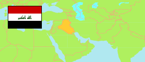
Al-Anbār
Governorate in Iraq
Contents: Subdivision
The population development in Al-Anbār as well as related information and services (Wikipedia, Google, images).
| Name | Status | Native | Population Estimate 2009-10-17 | Population Estimate 2018-07-01 | |
|---|---|---|---|---|---|
| Al-Anbār | Governorate | الانبار | 1,483,359 | 1,771,656 | |
| Al-'Āmiriyah | District | العامریة | 89,704 | 105,336 | → |
| Al-Fallūjah [Fallujah] | District | الفلوجة | 437,157 | 522,795 | → |
| Al-Ḥabbāniyah | District | الحبانیة | 118,131 | 138,754 | → |
| Al-Qā'im | District | القائم | 150,146 | 179,192 | → |
| 'Anah | District | عنھ | 26,162 | 31,575 | → |
| Ar-Ramādī [Ramadi] | District | الرمادي | 373,569 | 446,519 | → |
| Ar-Ruṭbah | District | الرطبة | 39,000 | 47,040 | → |
| Ḥadīṭha [Haditha] | District | حدیثة | 87,219 | 105,710 | → |
| Hīt | District | ھیت | 142,535 | 170,776 | → |
| Rāwah | District | راوة | 19,736 | 23,959 | → |
| Al-'Irāq [Iraq] | Republic | 31,664,466 | 38,124,182 |
Source: Central Organization for Statistics and Information Technology (web).
Explanation: Area figures of districts are computed by using geospatial data.