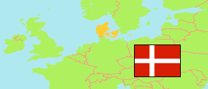
Assens
Municipality in Syddanmark
Municipality
The population development of Assens.
| Name | Status | Population Estimate 2006-01-01 | Population Estimate 2011-01-01 | Population Estimate 2016-01-01 | Population Estimate 2021-01-01 | Population Estimate 2025-01-01 | |
|---|---|---|---|---|---|---|---|
| Assens | Municipality | 41,369 | 41,635 | 41,224 | 40,867 | 40,469 | → |
| Syddanmark [South Denmark] | Region | 1,185,851 | 1,200,656 | 1,211,770 | 1,223,634 | 1,240,472 |
Contents: Urban Settlements
The population development of the urban settlements in Assens.
| Name | Status | Municipality | Population Estimate 2006-01-01 | Population Estimate 2011-01-01 | Population Estimate 2016-01-01 | Population Estimate 2021-01-01 | Population Estimate 2025-01-01 | |
|---|---|---|---|---|---|---|---|---|
| Aarup | Urban Settlement | Assens | 2,731 | 3,014 | 3,146 | 3,233 | 3,237 | → |
| Assens | Urban Settlement | Assens | 5,965 | 6,060 | 6,110 | 6,060 | 5,952 | → |
| Brylle | Urban Settlement | Assens | 1,153 | 1,183 | 1,233 | 1,285 | 1,306 | → |
| Ebberup | Urban Settlement | Assens | 1,306 | 1,308 | 1,272 | 1,207 | 1,233 | → |
| Flemløse | Urban Settlement | Assens | 674 | 639 | 623 | 601 | 581 | → |
| Gelsted | Urban Settlement | Middelfart / Assens | 1,651 | 1,684 | 1,705 | 1,728 | 1,713 | → |
| Glamsbjerg | Urban Settlement | Assens | 3,116 | 3,227 | 3,217 | 3,293 | 3,322 | → |
| Grønnemose | Urban Settlement | Assens | 370 | 400 | 386 | 361 | 400 | → |
| Haarby | Urban Settlement | Assens | 2,386 | 2,494 | 2,462 | 2,477 | 2,533 | → |
| Jordløse | Urban Settlement | Assens | 338 | 334 | 343 | 331 | 318 | → |
| Ørsted | Urban Settlement | Assens | 232 | 223 | 221 | 230 | 236 | → |
| Skalbjerg | Urban Settlement | Assens | 618 | 658 | 622 | 608 | 575 | → |
| Skallebølle | Urban Settlement | Assens / Odense | 658 | 679 | 692 | 699 | 712 | → |
| Snave | Urban Settlement | Assens | 246 | 277 | 231 | 218 | 212 | → |
| Tommerup | Urban Settlement | Assens | 1,628 | 1,618 | 1,601 | 1,558 | 1,567 | → |
| Tommerup Stationsby | Urban Settlement | Assens | 2,180 | 2,401 | 2,418 | 2,491 | 2,469 | → |
| Turup | Urban Settlement | Assens | 338 | 343 | 337 | 343 | 302 | → |
| Verninge | Urban Settlement | Assens | 771 | 741 | 766 | 779 | 757 | → |
| Vissenbjerg | Urban Settlement | Assens | 3,074 | 3,130 | 3,204 | 3,214 | 3,251 | → |
Source: Denmark Statistik.
