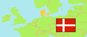
Ringsted
Municipality in Sjælland
Municipality
The population development of Ringsted.
| Name | Status | Population Estimate 2006-01-01 | Population Estimate 2011-01-01 | Population Estimate 2016-01-01 | Population Estimate 2021-01-01 | Population Estimate 2025-01-01 | |
|---|---|---|---|---|---|---|---|
| Ringsted | Municipality | 31,094 | 32,890 | 34,031 | 34,847 | 36,286 | → |
| Sjælland [Zealand] | Region | 811,511 | 819,763 | 827,499 | 838,840 | 854,902 |
Contents: Urban Settlements
The population development of the urban settlements in Ringsted.
| Name | Status | Municipality | Population Estimate 2006-01-01 | Population Estimate 2011-01-01 | Population Estimate 2016-01-01 | Population Estimate 2021-01-01 | Population Estimate 2025-01-01 | |
|---|---|---|---|---|---|---|---|---|
| Farendløse | Urban Settlement | Ringsted | 345 | 362 | 358 | 348 | 345 | → |
| Fjællebro | Urban Settlement | Ringsted | 250 | 235 | 229 | 233 | 224 | → |
| Gyrstinge | Urban Settlement | Ringsted | 335 | 348 | 333 | 340 | 343 | → |
| Høm | Urban Settlement | Ringsted | 470 | 472 | 468 | 475 | 468 | → |
| Jystrup | Urban Settlement | Ringsted | 638 | 744 | 741 | 747 | 875 | → |
| Kværkeby | Urban Settlement | Ringsted | 618 | 598 | 612 | 584 | 585 | → |
| Nordrup | Urban Settlement | Ringsted | 249 | 221 | 228 | 244 | 325 | → |
| Ørslev | Urban Settlement | Ringsted | 643 | 672 | 672 | 665 | 675 | → |
| Ortved | Urban Settlement | Ringsted | 247 | 260 | 252 | 253 | 244 | → |
| Ringsted | Urban Settlement | Ringsted | 19,234 | 21,151 | 22,231 | 22,941 | 24,094 | → |
| Sneslev | Urban Settlement | Ringsted | 360 | 390 | 413 | 408 | 415 | → |
| Vetterslev | Urban Settlement | Ringsted | 596 | 562 | 555 | 577 | 650 | → |
| Vigersted | Urban Settlement | Ringsted | 455 | 470 | 503 | 534 | 555 | → |
Source: Denmark Statistik.
