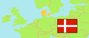
Læsø
Municipality in Nordjylland (Denmark)
Contents: Population
The population development of Læsø as well as related information and services (Wikipedia, Google, images).
| Name | Status | Population Estimate 2006-01-01 | Population Estimate 2011-01-01 | Population Estimate 2016-01-01 | Population Estimate 2021-01-01 | Population Estimate 2025-01-01 | |||||||||||||
|---|---|---|---|---|---|---|---|---|---|---|---|---|---|---|---|---|---|---|---|
| Læsø | Municipality | 2,091 | 1,949 | 1,817 | 1,764 | 1,719 | |||||||||||||
Læsø 1,719 Population [2025] – Estimate 122.1 km² Area 14.08/km² Population Density [2025] -0.64% Annual Population Change [2021 → 2025] | |||||||||||||||||||
| Danmark [Denmark] | Kingdom | 5,427,459 | 5,560,628 | 5,707,251 | 5,840,045 | 5,992,734 | |||||||||||||
Source: Denmark Statistik.
Further information about the population structure:
| Gender (E 2025) | |
|---|---|
| Males | 846 |
| Females | 873 |
| Age Groups (E 2025) | |
|---|---|
| 0-17 years | 199 |
| 18-64 years | 781 |
| 65+ years | 739 |
| Age Distribution (E 2025) | |
|---|---|
| 90+ years | 15 |
| 80-89 years | 181 |
| 70-79 years | 376 |
| 60-69 years | 328 |
| 50-59 years | 271 |
| 40-49 years | 128 |
| 30-39 years | 98 |
| 20-29 years | 105 |
| 10-19 years | 114 |
| 0-9 years | 103 |
| Citizenship (E 2025) | |
|---|---|
| Denmark | 1,619 |
| EU 27 | 60 |
| Europe (other) | 29 |
| Asia | 7 |
| Other Citizenship | 4 |
| Country of Birth (E 2025) | |
|---|---|
| Denmark | 1,594 |
| EU 27 | 71 |
| Europe (other) | 34 |
| Asia | 11 |
| Other country | 9 |
| Urbanization (E 2025) | |
|---|---|
| Rural | 693 |
| Urban | 1,026 |
