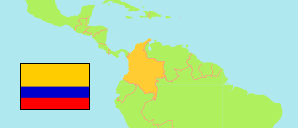
Chiriguaná
Municipality in Cesar
Municipality
The population development of Chiriguaná.
| Name | Status | Population Census 2005-06-30 | Population Census 2018-06-30 | |
|---|---|---|---|---|
| Chiriguaná | Municipality | 22,146 | 27,694 | → |
| Cesar | Department | 913,960 | 1,003,449 |
Contents: Urban Localities
The population development of the urban localities in Chiriguaná.
| Name | Status | Municipality | Population Census 2005-06-30 | Population Census 2018-06-30 | |
|---|---|---|---|---|---|
| Agua Fría | Population Center | Chiriguaná | 96 | 149 | → |
| Arenas Blancas | Population Center | Chiriguaná | 221 | 323 | → |
| Cerrajones | Population Center | Chiriguaná | ... | 344 | → |
| Chiriguaná | Capital | Chiriguaná | 13,686 | 16,576 | → |
| El Cruce de la Sierra | Population Center | Chiriguaná | 401 | 522 | → |
| Estación Chiriguaná | Population Center | Chiriguaná | 94 | 215 | → |
| La Aurora | Population Center | Chiriguaná | 594 | 1,281 | → |
| La Sierra | Population Center | Chiriguaná | 578 | 918 | → |
| Poponte | Population Center | Chiriguaná | 991 | 1,235 | → |
| Rincón Hondo | Population Center | Chiriguaná | 2,737 | 3,713 | → |
Source: Departamento Administrativo Nacional de Estadistica, Republica de Columbia (web).
Explanation: In constrast to municipalities and their capitals, the population figures of population centers are not adjusted for underenumeration.