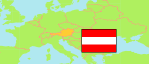
Amstetten
City in Amstetten District
City
The population development of Amstetten.
| Name | Status | Population Census 2001-05-15 | Population Census 2011-10-31 | Population Estimate 2022-01-01 | Population Estimate 2024-01-01 | |
|---|---|---|---|---|---|---|
| Amstetten | City | 22,592 | 22,847 | 23,653 | 23,899 | → |
Contents: Localities
The population development of the localities in Amstetten.
| Name | Status | Commune | Population Census 2001-05-15 | Population Census 2011-10-31 | Population Estimate 2022-01-01 | Population Estimate 2024-01-01 | |
|---|---|---|---|---|---|---|---|
| Amstetten (incl. Edla, Preinsbach, Schönbichl) | Locality | Amstetten | 15,249 | 15,357 | 15,521 | 15,678 | → |
| Greinsfurth | Locality | Amstetten | 1,014 | 1,040 | 1,194 | 1,212 | → |
| Hausmening | Locality | Amstetten | 1,812 | 2,023 | 1,936 | 1,957 | → |
| Mauer bei Amstetten | Locality | Amstetten | 2,086 | 2,068 | 2,336 | 2,328 | → |
| Neufurth | Locality | Amstetten | 1,594 | 1,496 | 1,739 | 1,808 | → |
| Ulmerfeld | Locality | Amstetten | 840 | 863 | 927 | 916 | → |
Source: Statistik Austria.
Explanation: Localities are defined independently of the type of settlement by municipal and state laws; they may be, e.g., closed settlements, scattered settlements or combinations thereof.