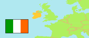
Carlow (Irland)
Grafschaft
Die Einwohnerentwicklung von Carlow.
| Name | Status | Einwohner Zensus 1991-04-21 | Einwohner Zensus 1996-04-28 | Einwohner Zensus 2002-04-28 | Einwohner Zensus 2006-04-23 | Einwohner Zensus 2011-04-10 | Einwohner Zensus 2016-04-24 | Einwohner Zensus 2022-04-03 | |
|---|---|---|---|---|---|---|---|---|---|
| Carlow | Grafschaft | 40.942 | 41.616 | 46.014 | 50.349 | 54.612 | 56.932 | 61.968 | → |
| Ireland (Éire) [Irland] | Republik | 3.525.719 | 3.626.087 | 3.917.203 | 4.239.848 | 4.588.252 | 4.761.865 | 5.149.139 |
Übersicht: Siedlungen
Die Bevölkerungsentwicklung der Siedlungen in Carlow.
| Name | Status | Grafschaft (County) | Einwohner Zensus 1991-04-21 | Einwohner Zensus 1996-04-28 | Einwohner Zensus 2002-04-28 | Einwohner Zensus 2006-04-23 | Einwohner Zensus 2011-04-10 | Einwohner Zensus 2016-04-24 | Einwohner Zensus 2022-04-03 | |
|---|---|---|---|---|---|---|---|---|---|---|
| Ballinabrannagh (Ballinabranna) | Siedlung | Carlow | ... | ... | ... | ... | 389 | 466 | 557 | → |
| Ballon | Siedlung | Carlow | 281 | 258 | 284 | 596 | 684 | 712 | 801 | → |
| Borris | Siedlung | Carlow | 588 | 584 | 580 | 582 | 646 | 652 | 702 | → |
| Carlow | Agglomeration | Carlow / Laois | 14.027 | 14.979 | 18.487 | 20.724 | 23.030 | 24.272 | 27.351 | → |
| Clonegal (Clonegall) | Siedlung | Carlow | ... | ... | ... | ... | ... | ... | 249 | → |
| Fennagh | Siedlung | Carlow | ... | ... | ... | ... | 384 | 402 | 479 | → |
| Graiguenamanagh - Tinnahinch | Siedlung | Carlow / Kilkenny | 1.395 | 1.374 | 1.435 | 1.376 | 1.543 | 1.475 | 1.506 | → |
| Hacketstown | Siedlung | Carlow | 707 | 628 | 614 | 606 | 600 | 597 | 653 | → |
| Kernanstown | Siedlung | Carlow | 287 | 277 | 244 | 230 | 221 | 214 | 269 | → |
| Kildavin | Siedlung | Carlow | ... | ... | ... | 170 | 194 | 184 | 207 | → |
| Leighlinbridge | Siedlung | Carlow | 510 | 508 | 646 | 674 | 828 | 914 | 959 | → |
| Muinebeag (Bagenalstown) | Agglomeration | Carlow | 2.700 | 2.695 | 2.728 | 2.735 | 2.950 | 2.837 | 2.945 | → |
| Myshall | Siedlung | Carlow | ... | ... | ... | 200 | 302 | 286 | 292 | → |
| Palatine | Siedlung | Carlow | ... | ... | ... | ... | ... | ... | 276 | → |
| Rathtoe | Siedlung | Carlow | ... | ... | ... | ... | 303 | 304 | 296 | → |
| Rathvilly | Siedlung | Carlow | 531 | 458 | 500 | 796 | 881 | 944 | 1.074 | → |
| Tinryland (Tinriland) | Siedlung | Carlow | ... | ... | ... | ... | ... | ... | 338 | → |
| Tullow | Siedlung | Carlow | 2.424 | 2.364 | 2.417 | 3.048 | 3.972 | 4.673 | 5.138 | → |
Quelle: Central Statistics Office, Ireland.