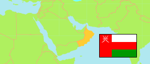
Al-Mazyūnah
District in Dhofar Governorate
District
The population development of Al-Mazyūnah.
| Name | Native | Status | Population Census 2003-12-07 | Population Census 2010-12-12 | Population Census 2020-12-12 | |
|---|---|---|---|---|---|---|
| Al-Mazyūnah [← Muqshin] | المزيونة | District | ... | 8,039 | 8,399 | → |
| Ẓufār [Dhofar] | ظفار | Governorate | 215,960 | 249,729 | 416,458 |
Contents: Localities
The population development of the localities in Al-Mazyūnah.
| Name | Native | Status | District | Population Census 2003-12-07 | Population Census 2010-12-12 | Population Census 2020-12-12 | |
|---|---|---|---|---|---|---|---|
| Al-Mazyunah | المزيونة | Locality | Al-Mazyūnah | 2,130 | 4,257 | 5,508 | → |
| Andat | اندات | Locality | Al-Mazyūnah | 289 | 367 | 288 | → |
| Habrut | حبروت | Locality | Al-Mazyūnah | 250 | 477 | 270 | → |
| Harwib | هرويب | Locality | Al-Mazyūnah | 411 | 582 | 768 | → |
| Hayrun | حيرون | Locality | Al-Mazyūnah | 119 | 65 | 75 | → |
| Jajwal | ججوال | Locality | Al-Mazyūnah | 83 | 191 | 142 | → |
| Maturah | مطورة | Locality | Al-Mazyūnah | 123 | 165 | 258 | → |
| Mitan | ميتن | Locality | Al-Mazyūnah | 663 | 790 | 541 | → |
| Tawsinat | توسنات | Locality | Al-Mazyūnah | 184 | 248 | 336 | → |
| Zaynah | زينة | Locality | Al-Mazyūnah | 195 | 235 | 177 | → |
Source: Sultanate of Oman, National Centre for Statistics and Information (web).
Explanation: The 2020 census was organized as an electronic census.