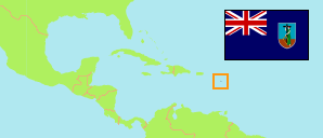
The vulcanic eruption in 1997 destroyed the southern part including the former capital Plymouth. Interim government buildings have been built at Brades.
Census Regions
The population of the census regions of Montserrat by census years.
| Name | Abbr. | Status | Area A (hect) | Population Census (C) 1980-05-12 | Population Census (C) 1991-05-12 | Population Census (C) 2001-05-12 | Population Census (C) 2011-05-12 | Population Census (C) 2018-09-22 | Population Census (Cp) 2023-09-12 | ||
|---|---|---|---|---|---|---|---|---|---|---|---|
| Central Region | CEN | Reg | 532 | ... | ... | ... | 1,666 | 1,475 | ... | 532 | |
| Centre Hills Forest Reserve | CHFR | 1,050 | 0 | 0 | 0 | 0 | 0 | ... | 1050 | ||
| Exclusion Zone | - | Zone | 6,360 | ... | ... | 0 | 0 | 0 | ... | 6360 | |
| Northern Region | NOR | Reg | 1,737 | ... | ... | ... | 2,369 | 2,163 | ... | 1737 | |
| South of Nantes River | SNR | Reg | 519 | ... | ... | ... | 887 | 928 | ... | 519 | |
| Montserrat | MSR | OvTerr | 10,200 | 11,685 | 11,314 | 4,491 | 4,922 | 4,649 | 4,386 |
- The 2018 intercensal population count locates institutional population (83 persons) in no census region.
- (1980) (1991) (2001) CARICOM: National Census Report Montserrat, 2009.
(2011) (2018) (2023) Statistics Department Montserrat.
Contents: Villages
The population of all Montserratian villages by census years.
| Name | Adm. | Population Census (C) 1980-05-12 | Population Census (C) 2011-05-12 | Population Census (C) 2018-09-22 | Area |
|---|---|---|---|---|---|
| Baker Hill | CEN | ... | 236 | 211 | 70 |
| Barzeys | NOR | ... | 147 | 208 | 119 |
| Brades (/ Shinnlands) | CEN | ... | 449 | 393 | 111 |
| Cudjoe Head | CEN | ... | 137 | 131 | 12 |
| Davy Hill | NOR | ... | 535 | 410 | 72 |
| Drummonds | NOR | ... | 145 | 121 | 590 |
| Friths (/ Flemmings) | SNR | ... | 169 | 175 | 48 |
| Gerald's (/ Little Bay) | NOR | ... | 180 | 133 | 224 |
| Judy Piece | NOR | ... | 253 | 190 | 39 |
| Look Out (/ Blakes) | NOR | ... | 670 | 696 | 566 |
| Nixons (/ Banks) | CEN | ... | 131 | 118 | 33 |
| Old Towne (/ Happy Hill / Isles Bay) | SNR | ... | 81 | 109 | 240 |
| Olveston | SNR | ... | 292 | 324 | 127 |
| Plymouth | - | 1,478 | 0 | 0 | 0 |
| Salem | SNR | ... | 345 | 320 | 104 |
| St. John's (/ Mongo Hill) | NOR | ... | 439 | 405 | 127 |
| St. Peter's | CEN | ... | 436 | 380 | 200 |
| Woodlands | CEN | ... | 277 | 242 | 106 |
- The 2018 intercensal population count locates institutional population (83 persons) in no village.
- (2011) (2018) Statistics Department Montserrat.
Population Structure
Further information about the population structure.
| Gender (C 2018) | |
|---|---|
| Males | 2,256 |
| Females | 2,310 |
| Age Groups (C 2018) | |
|---|---|
| 0-14 years | 853 |
| 15-64 years | 3,025 |
| 65+ years | 688 |
| Age Distribution (C 2018) | |
|---|---|
| 70+ years | 457 |
| 60-69 years | 518 |
| 50-59 years | 669 |
| 40-49 years | 653 |
| 30-39 years | 622 |
| 20-29 years | 527 |
| 10-19 years | 583 |
| 0-9 years | 537 |
