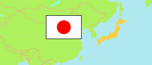
Fukushima
Prefecture in Japan
Contents: Subdivision
The population development in Fukushima as well as related information and services (Wikipedia, Google, images).
| Name | Status | Native | Population Census 1995-10-01 | Population Census 2000-10-01 | Population Census 2005-10-01 | Population Census 2010-10-01 | Population Census 2015-10-01 | Population Census 2020-10-01 | |
|---|---|---|---|---|---|---|---|---|---|
| Fukushima | Prefecture | 福島県 | 2,133,592 | 2,126,935 | 2,091,319 | 2,029,064 | 1,914,039 | 1,833,152 | |
| Adachi | District (-gun) | 安達郡 | 8,339 | 8,407 | 8,464 | 8,574 | 8,679 | 8,900 | → |
| Aizuwakamatsu | City (-shi) | 会津若松市 | 137,065 | 135,415 | 131,389 | 126,220 | 124,062 | 117,376 | → |
| Date | City (-shi) | 伊達市 | 73,305 | 71,817 | 69,289 | 66,027 | 62,400 | 58,240 | → |
| Date | District (-gun) | 伊達郡 | 45,000 | 42,649 | 41,137 | 38,508 | 36,235 | 32,268 | → |
| Fukushima | City (-shi) | 福島市 | 292,696 | 297,894 | 297,357 | 292,590 | 294,247 | 282,693 | → |
| Futaba | District (-gun) | 双葉郡 | 77,795 | 76,545 | 74,158 | 72,822 | 7,333 | 16,484 | → |
| Higashishirakawa | District (-gun) | 東白川郡 | 40,656 | 39,336 | 37,476 | 35,283 | 32,979 | 30,086 | → |
| Ishikawa | District (-gun) | 石川郡 | 51,914 | 49,806 | 47,844 | 44,845 | 41,112 | 37,723 | → |
| Iwaki | City (-shi) | いわき市 | 360,598 | 360,138 | 354,492 | 342,249 | 350,237 | 332,931 | → |
| Iwase | District (-gun) | 岩瀬郡 | 19,531 | 19,632 | 19,232 | 19,106 | 18,097 | 17,512 | → |
| Kawanuma | District (-gun) | 河沼郡 | 28,861 | 27,696 | 26,104 | 24,733 | 23,045 | 21,230 | → |
| Kitakata | City (-shi) | 喜多方市 | 59,554 | 58,571 | 56,396 | 52,356 | 49,377 | 44,760 | → |
| Kōriyama | City (-shi) | 郡山市 | 326,833 | 334,824 | 338,834 | 338,712 | 335,444 | 327,692 | → |
| Minamiaizu | District (-gun) | 南会津郡 | 36,541 | 34,988 | 32,913 | 29,893 | 27,149 | 24,263 | → |
| Minamisōma | City (-shi) | 南相馬市 | 77,860 | 75,246 | 72,837 | 70,878 | 57,797 | 59,005 | → |
| Motomiya | City (-shi) | 本宮市 | 30,682 | 31,541 | 31,367 | 31,489 | 30,924 | 30,236 | → |
| Nihonmatsu | City (-shi) | 二本松市 | 67,269 | 66,077 | 63,178 | 59,871 | 58,162 | 53,557 | → |
| Nishishirakawa | District (-gun) | 西白河郡 | 49,047 | 49,631 | 50,164 | 50,130 | 49,188 | 49,193 | → |
| Ōnuma | District (-gun) | 大沼郡 | 35,249 | 33,724 | 31,457 | 28,625 | 26,092 | 23,574 | → |
| Shirakawa | City (-shi) | 白河市 | 65,155 | 66,048 | 65,707 | 64,704 | 61,913 | 59,491 | → |
| Sōma | City (-shi) | 相馬市 | 39,449 | 38,842 | 38,630 | 37,817 | 38,556 | 34,865 | → |
| Sōma | District (-gun) | 相馬郡 | 16,679 | 16,110 | 15,306 | 14,433 | 8,259 | 9,223 | → |
| Sukagawa | City (-shi) | 須賀川市 | 77,020 | 79,409 | 80,364 | 79,267 | 77,441 | 74,992 | → |
| Tamura | City (-shi) | 田村市 | 46,129 | 45,052 | 43,253 | 40,422 | 38,503 | 35,169 | → |
| Tamura | District (-gun) | 田村郡 | 33,430 | 32,531 | 31,299 | 29,393 | 28,779 | 26,489 | → |
| Yama | District (-gun) | 耶麻郡 | 36,935 | 35,006 | 32,672 | 30,117 | 28,029 | 25,200 | → |
| Nippon [Japan] | State | 日本国 | 125,570,246 | 126,925,843 | 127,767,994 | 128,057,352 | 127,094,745 | 126,146,099 |
Source: Statistics Bureau Japan (web).
Further information about the population structure:
| Gender (C 2020) | |
|---|---|
| Males | 903,864 |
| Females | 929,288 |
| Age Groups (C 2020) | |
|---|---|
| 0-17 years | 258,877 |
| 18-64 years | 967,516 |
| 65+ years | 572,825 |
| Age Distribution (C 2020) | |
|---|---|
| 90+ years | 44,031 |
| 80-89 years | 147,919 |
| 70-79 years | 235,544 |
| 60-69 years | 276,609 |
| 50-59 years | 234,035 |
| 40-49 years | 238,042 |
| 30-39 years | 188,268 |
| 20-29 years | 147,438 |
| 10-19 years | 157,033 |
| 0-9 years | 130,299 |
| Citizenship (C 2020) | |
|---|---|
| Japanese | 1,797,450 |
| Foreign Citizenship | 12,868 |
