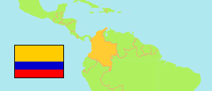
Curumaní
Municipality in Cesar
Municipality
The population development of Curumaní.
| Name | Status | Population Census 2005-06-30 | Population Census 2018-06-30 | |
|---|---|---|---|---|
| Curumaní | Municipality | 27,560 | 37,399 | → |
| Cesar | Department | 913,960 | 1,003,449 |
Contents: Urban Localities
The population development of the urban localities in Curumaní.
| Name | Status | Municipality | Population Census 2005-06-30 | Population Census 2018-06-30 | |
|---|---|---|---|---|---|
| Barrio Acosta | Population Center | Curumaní | 97 | 75 | → |
| Champán | Population Center | Curumaní | 69 | 101 | → |
| Chinela | Population Center | Curumaní | ... | 167 | → |
| Curumaní | Capital | Curumaní | 18,514 | 26,422 | → |
| El Mamey | Population Center | Curumaní | ... | 279 | → |
| Guaimaral | Population Center | Curumaní | 233 | 195 | → |
| Hojancha | Population Center | Curumaní | 17 | 41 | → |
| Nuevo Horizonte | Population Center | Curumaní | ... | 27 | → |
| Sabanagrande | Population Center | Curumaní | 788 | 983 | → |
| San Roque | Population Center | Curumaní | 3,091 | 3,254 | → |
| San Sebastián | Population Center | Curumaní | 648 | 535 | → |
| Santa Isabel | Population Center | Curumaní | 497 | 929 | → |
Source: Departamento Administrativo Nacional de Estadistica, Republica de Columbia (web).
Explanation: In constrast to municipalities and their capitals, the population figures of population centers are not adjusted for underenumeration.