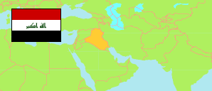
Iraq: Baghdad Governorate
Contents: Districts and Subdistricts
The population of the districts and subdistricts of Baghdad Governorate according to official population estimates.
| Name | Status | Native | Population Estimate 2009-10-17 | Population Estimate 2018-07-01 | |
|---|---|---|---|---|---|
| Abū Ghraīb | District | أبو غريب | 269,171 | 323,068 | → |
| Abū Ghraīb | Central Subdistrict | أبو غريب | 129,229 | 155,852 | → |
| An-Naṣir & As-Salām | Subdistrict | النصر والسلام | 139,942 | 167,216 | → |
| Al-Ā'ẓamiyah [Adhamiyah] | District | الاعظمیة | 989,000 | 1,202,492 | → |
| Al-Ā'ẓamiyah | Central Subdistrict | الاعظمیة | 244,167 | 297,157 | → |
| Al-Faḥāmah | Subdistrict | الفحامة | 528,797 | 643,558 | → |
| Ar-Rāshidiyah | Subdistrict | الراشدیة | 36,691 | 43,678 | → |
| Az-Zahūr | Subdistrict | الزھور | 179,345 | 218,099 | → |
| Al-Karkh | District | الكرخ | 1,309,488 | 1,593,676 | → |
| Al-Karkh | Central Subdistrict | الكرخ | 96,799 | 117,806 | → |
| Al-M'āmūn | Subdistrict | المأمون | 841,500 | 1,024,124 | → |
| Al-Manṣūr | Subdistrict | المنصور | 371,189 | 451,746 | → |
| Al-Kāẓimiyyah [Kadhimiya] | District | الكاظمیة | 740,684 | 897,396 | → |
| Al-Kāẓimiyyah | Central Subdistrict | الكاظمیة | 359,348 | 437,335 | → |
| At-Tājī | Subdistrict | التاجي | 143,979 | 171,717 | → |
| Dhāt as-Salāsil | Subdistrict | ذات السلاسل | 237,357 | 288,344 | → |
| Al-Madā'in | District | المدائن | 383,868 | 459,673 | → |
| Al-Jisr | Subdistrict | الجسر | 138,631 | 165,839 | → |
| Al-Madā'in | Central Subdistrict | المدائن | 67,797 | 80,936 | → |
| Al-Waḥdah | Subdistrict | الوحدة | 177,440 | 212,898 | → |
| Al-Maḥmūdiyah [Mahmoudiyah] | District | المحمودیة | 405,838 | 484,004 | → |
| Al-Laṭīfiyah | Subdistrict | اللطیفیة | 86,031 | 102,226 | → |
| Al-Maḥmūdiyah | Central Subdistrict | المحمودیة | 133,725 | 160,965 | → |
| Al-Yūsufiyah | Subdistrict | الیوسفیة | 115,592 | 137,046 | → |
| Ar-Rashīd | Subdistrict | الرشید | 70,490 | 83,767 | → |
| Ar-Ruṣāfah | District | الرصافة | 1,486,799 | 1,809,468 | → |
| Al-Karādah ash-Sharqiyah | Subdistrict | الكرادة الشرقیة | 271,977 | 331,002 | → |
| Ar-Ruṣāfah | Central Subdistrict | الرصافة | 100,743 | 122,607 | → |
| Baghdād al-Jidīdah | Subdistrict | بغداد الجدیدة | 1,034,534 | 1,259,051 | → |
| Falasṭīn | Subdistrict | فلسطین | 79,545 | 96,808 | → |
| Aṣ-Ṣadr al-Āwlā [Sadr City 1] | District | الصدر الاولى | 582,067 | 708,388 | → |
| Al-Furāt | Subdistrict | الفرات | 324,094 | 394,429 | → |
| Aṣ-Ṣadīq al-Akbar | Subdistrict | الصدیق الاكبر | 146,872 | 178,747 | → |
| Aṣ-Ṣadr al-Āwlā | Central Subdistrict | الصدر الاولى | 111,101 | 135,212 | → |
| Aṣ-Ṣadr ath-Thāniyah [Sadr City 2] | District | الصدر الثانیة | 413,683 | 503,461 | → |
| Abnā'a ar-Rāfadaīn | Subdistrict | ابناء الرافدین | 131,212 | 159,688 | → |
| Al-Munawarah | Subdistrict | المنورة | 245,672 | 298,988 | → |
| Aṣ-Ṣadr ath-Thāniyah | Central Subdistrict | الصدر الثانیة | 36,799 | 44,785 | → |
| Aṭ-Ṭārmiyah | District | الطارمية | 121,940 | 145,129 | → |
| Al-'Abāījī | Subdistrict | العبایجي | 12,820 | 15,149 | → |
| Al-Mushāhidah | Subdistrict | المشاھدة | 28,508 | 33,688 | → |
| Aṭ-Ṭārmiyah | Central Subdistrict | الطارمية | 80,612 | 96,292 | → |
| Baghdād | Governorate | بغداد | 6,702,538 | 8,126,755 |
Source: Central Organization for Statistics and Information Technology (web).
Explanation: Area figures are computed by using geospatial data.