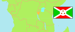
Burundi: Administrative Division
Contents: Burundi
Republic
8,053,574 Population [2008] – census
12,332,788 Population [2024] – census
27,834km² Area
443.1/km² Density [2024]
Contents: Provinces and Communes
The population of the provinces and communes of Burundi according to census results.
| Name | Status | Population Census 2008-08-16 | Population Census 2024-08-16 | |
|---|---|---|---|---|
| Buhumuza | Province | 1,261,812 | 2,052,261 | → |
| Butaganzwa | Commune | 70,448 | 109,813 | → |
| Butihinda | Commune | 314,227 | 434,166 | → |
| Cankuzo | Commune | 86,223 | 161,287 | → |
| Gisagara | Commune | 140,128 | 291,398 | → |
| Gisuru | Commune | 205,685 | 337,649 | → |
| Muyinga | Commune | 318,182 | 495,927 | → |
| Ruyigi | Commune | 126,919 | 222,021 | → |
| Bujumbura | Province | 1,874,266 | 3,353,555 | → |
| Bubanza | Commune | 165,885 | 242,978 | → |
| Bukinanyana | Commune | 173,922 | 269,547 | → |
| Cibitoke | Commune | 131,695 | 260,776 | → |
| Isare | Commune | 109,703 | 149,273 | → |
| Mpanda | Commune | 172,138 | 362,261 | → |
| Mugere | Commune | 267,569 | 512,881 | → |
| Mugina | Commune | 154,818 | 225,284 | → |
| Muhuta | Commune | 91,115 | 117,061 | → |
| Mukaza | Commune | 152,347 | 168,829 | → |
| Ntahangwa | Commune | 355,260 | 927,907 | → |
| Rwibaga | Commune | 99,814 | 116,758 | → |
| Burunga | Province | 1,351,719 | 2,118,551 | → |
| Bururi | Commune | 159,410 | 189,958 | → |
| Makamba | Commune | 227,088 | 370,637 | → |
| Matana | Commune | 166,989 | 195,269 | → |
| Musongati | Commune | 199,135 | 336,347 | → |
| Nyanza | Commune | 203,811 | 369,669 | → |
| Rumonge | Commune | 260,911 | 429,237 | → |
| Rutana | Commune | 134,375 | 227,434 | → |
| Butanyerera | Province | 1,905,622 | 2,530,206 | → |
| Busoni | Commune | 269,566 | 357,991 | → |
| Kayanza | Commune | 240,880 | 332,433 | → |
| Kiremba | Commune | 218,370 | 292,027 | → |
| Kirundo | Commune | 358,690 | 478,492 | → |
| Matongo | Commune | 217,225 | 265,900 | → |
| Muhanga | Commune | 184,974 | 222,791 | → |
| Ngozi | Commune | 220,854 | 316,808 | → |
| Tangara | Commune | 195,063 | 263,764 | → |
| Gitega | Province | 1,660,155 | 2,278,215 | → |
| Bugendana | Commune | 173,741 | 229,652 | → |
| Gishubi | Commune | 199,568 | 243,533 | → |
| Gitega | Commune | 338,617 | 528,528 | → |
| Karusi | Commune | 254,753 | 377,638 | → |
| Kiganda | Commune | 117,995 | 149,522 | → |
| Muramvya | Commune | 120,648 | 171,010 | → |
| Mwaro | Commune | 124,212 | 149,190 | → |
| Nyabihanga | Commune | 148,931 | 175,208 | → |
| Shombo | Commune | 181,690 | 253,934 | → |
| Burundi | Republic | 8,053,574 | 12,332,788 |
Source: L'Institut de Statistiques et d’Etudes Economiques du Burundi
Explanation: Provinces and communes according to the territorial reform of 2023. The results of the 2024 census are preliminary. Area figures are calculated using geospatial data.