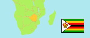
Masvingo
Province in Zimbabwe
Contents: Subdivision
The population development in Masvingo as well as related information and services (Wikipedia, Google, images).
| Name | Status | Population Census 2002-08-18 | Population Census 2012-08-17 | Population Census 2022-04-20 | |
|---|---|---|---|---|---|
| Masvingo | Province | 1,320,438 | 1,485,090 | 1,638,528 | |
| Bikita | District | 156,940 | 162,356 | 176,835 | → |
| Chiredzi Rural | District | 208,171 | 275,759 | 303,503 | → |
| Chiredzi Urban | Urban District | 25,849 | 30,448 | 40,457 | → |
| Chivi | District | 155,640 | 166,049 | 172,979 | → |
| Gutu | District | 198,536 | 203,083 | 208,149 | → |
| Masvingo Rural | District | 194,467 | 211,215 | 238,103 | → |
| Masvingo Urban | Urban District | 69,490 | 87,886 | 90,286 | → |
| Mwenezi | District | 126,238 | 166,993 | 209,327 | → |
| Zaka | District | 185,107 | 181,301 | 198,889 | → |
| Zimbabwe | Republic | 11,631,657 | 13,061,239 | 15,178,957 |
Source: Zimbabwe National Statistics Agency (web).
Explanation: Areas figures are computed by using geospatial data.
Further information about the population structure:
| Gender (C 2022) | |
|---|---|
| Males | 763,413 |
| Females | 875,115 |
| Age Groups (C 2012) | |
|---|---|
| 0-14 years | 669,112 |
| 15-64 years | 739,048 |
| 65+ years | 72,403 |
| Age Distribution (C 2012) | |
|---|---|
| 0-9 years | 454,983 |
| 10-19 years | 374,095 |
| 20-29 years | 216,056 |
| 30-39 years | 169,036 |
| 40-49 years | 88,726 |
| 50-59 years | 76,447 |
| 60-69 years | 50,783 |
| 70+ years | 50,437 |
| Urbanization (C 2012) | |
|---|---|
| Rural | 1,340,270 |
| Urban | 144,820 |