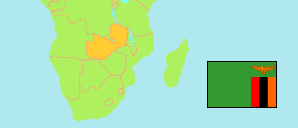
Chililabombwe
District in Zambia
Contents: Subdivision
The population in Chililabombwe as well as related information and services (Wikipedia, Google, images).
| Name | Status | Population Census 2010-10-16 | |
|---|---|---|---|
| Chililabombwe | District | 91,833 | |
| Anoya Zulu | Ward | 1,384 | → |
| Chilimina | Ward | 2,787 | → |
| Chitambi | Ward | 629 | → |
| Chitimukulu | Ward | 2,823 | → |
| Helen Kaunda | Ward | 3,121 | → |
| James Phiri | Ward | 7,496 | → |
| Joseph Mwilwa | Ward | 3,807 | → |
| Kafue | Ward | 3,796 | → |
| Kakoso | Ward | 6,158 | → |
| Kamima | Ward | 4,014 | → |
| Kawama | Ward | 1,329 | → |
| Mathew Nkoloma | Ward | 5,471 | → |
| Miteta | Ward | 6,094 | → |
| Miyanda | Ward | 2,367 | → |
| Mukuka | Ward | 5,965 | → |
| Mumba | Ward | 2,270 | → |
| Mvula | Ward | 2,789 | → |
| Nakatindi | Ward | 7,316 | → |
| Ngebe | Ward | 4,697 | → |
| Silwizya | Ward | 809 | → |
| Yeta | Ward | 4,502 | → |
| Yotam Muleya | Ward | 12,209 | → |
| Zambia | Republic | 13,092,666 |
Source: Central Statistical Office Zambia (web).
Explanation: Districts in the boundaries of 2016 and wards in the the boundaries of 2010; slight deviations from the actual situation are possible. Area figures are computed by using geospatial data.