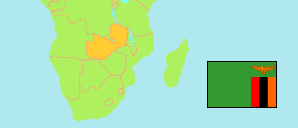
Muchinga
Province in Zambia
Contents: Subdivision
The population development in Muchinga as well as related information and services (Wikipedia, Google, images).
| Name | Status | Population Census 2000-10-20 | Population Census 2010-10-16 | Population Census 2022-08-18 | |
|---|---|---|---|---|---|
| Muchinga | Province | 449,296 | 607,763 | 922,213 | |
| Chinsali | District | 74,039 | 86,723 | 148,996 | → |
| Isoka | District | 57,239 | 72,189 | 109,806 | → |
| Kanchibiya (← Mpika) | District | ... | 82,151 | 93,240 | → |
| Lavushimanda (← Mpika) | District | ... | 40,677 | 55,835 | → |
| Mafinga | District | 42,080 | 65,969 | 102,654 | → |
| Mpika | District | ... | 80,551 | 150,670 | → |
| Nakonde | District | 75,135 | 119,708 | 181,725 | → |
| Shiwang'andu | District | 54,607 | 59,795 | 79,287 | → |
| Zambia | Republic | 9,885,591 | 13,092,666 | 19,693,423 |
Source: Central Statistical Office Zambia.
Explanation: Provinces and districts in 2022 boundaries. The reference period of the 2022 census is 18 August to 7 September.