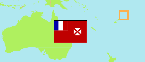
Vaisei
Village in Wallis and Futuna
Contents: Population
The population development of Vaisei as well as related information and services (Wikipedia, Google, images).
| Name | Status | Population Census 1990-10-09 | Population Census 1996-10-03 | Population Census 2003-07-22 | Population Census 2008-07-21 | Population Census 2013-07-22 | Population Census 2018-07-23 | Population Census 2023-07-24 | |
|---|---|---|---|---|---|---|---|---|---|
| Vaisei | Village | 235 | 200 | 221 | 196 | 159 | 160 | 139 | |
| Wallis-et-Futuna [Wallis and Futuna] | French Overseas Collectivity | 13,705 | 14,166 | 14,944 | 13,445 | 12,197 | 11,558 | 11,151 |
Source: Institut National de la Statistique et des Études Économiques France; Service Territorial de la Statistique et des Études Économiques, Wallis et Futuna.
Explanation: Area figures of villages are computed by using geospatial data.
Further information about the population structure:
| Gender (C 2023) | |
|---|---|
| Males | 64 |
| Females | 75 |
| Age Groups (C 2023) | |
|---|---|
| 0-14 years | 27 |
| 15-64 years | 93 |
| 65+ years | 19 |
| Age Distribution (C 2023) | |
|---|---|
| 80+ years | 3 |
| 70-79 years | 11 |
| 60-69 years | 8 |
| 50-59 years | 20 |
| 40-49 years | 23 |
| 30-39 years | 15 |
| 20-29 years | 19 |
| 10-19 years | 19 |
| 0-9 years | 21 |
| Citizenship (C 2023) | |
|---|---|
| France | 139 |
| Country of Birth (C 2023) | |
|---|---|
| Wallis and Futuna | 119 |
| New Caledonia | 19 |
| France | 1 |