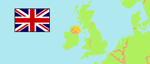
Botanic U2
Data Zone in Belfast Agglomeration
Contents: Population
The population development of Botanic U2 as well as related information and services (Wikipedia, Google, images).
Source: The Northern Ireland Statistics and Research Agency (web)
Further information about the population structure:
| Gender (C 2021) |
|---|
| Males | 364 |
| Females | 278 |
| Age Groups (C 2021) |
|---|
| 0-17 years | 65 |
| 18-64 years | 534 |
| 65+ years | 43 |
| Age Distribution (C 2021) |
|---|
| 90+ years | 2 |
| 80-89 years | 12 |
| 70-79 years | 20 |
| 60-69 years | 25 |
| 50-59 years | 33 |
| 40-49 years | 56 |
| 30-39 years | 105 |
| 20-29 years | 309 |
| 10-19 years | 37 |
| 0-9 years | 41 |
| Country of Birth (C 2021) |
|---|
| Northern Ireland | 443 |
| Great Britain | 51 |
| Republic of Ireland | 23 |
| Other country | 125 |
| Ethnic Group (C 2021) |
|---|
| White | 541 |
| Other ethnic group | 101 |
| Religion (C 2021) |
|---|
| Catholics | 171 |
| Church of Ireland | 48 |
| Presbyterians | 45 |
| Other Christians | 66 |
| Other religion | 57 |
| No religion | 236 |
| Main Language (A3+) (C 2021) |
|---|
| English | 548 |
| Other language | 85 |
