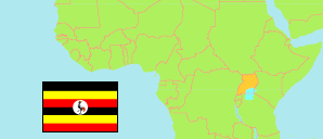
Tooro
Subregion in Uganda
Contents: Subdivision
The population development in Tooro as well as related information and services (Wikipedia, Google, images).
| Name | Status | Population Census 2014-08-27 | Population Census 2024-05-10 | |
|---|---|---|---|---|
| Tooro | Subregion | 1,587,531 | 2,154,161 | |
| Bunyangabu | District | 170,247 | 219,012 | → |
| Fort Portal City | City | 102,240 | 137,549 | → |
| Kabarole | District | 196,749 | 230,368 | → |
| Kamwenge | District | 270,668 | 337,167 | → |
| Kitagwenda | District | 143,786 | 184,947 | → |
| Kyegegwa | District | 281,637 | 501,120 | → |
| Kyenjojo | District | 422,204 | 543,998 | → |
| Uganda | Republic | 34,634,650 | 45,905,417 |
Source: Uganda Bureau of Statistics.
Further information about the population structure:
| Gender (C 2024) | |
|---|---|
| Males | 1,040,079 |
| Females | 1,114,082 |
| Age Groups (C 2024) | |
|---|---|
| 0-14 years | 953,848 |
| 15-64 years | 1,127,021 |
| 65+ years | 73,292 |