HomeAdministrative Division
Tweet
Facebook
Show Map

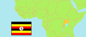
Teso

Subregion in Uganda

Contents: Subdivision

The population development in Teso as well as related information and services (Wikipedia, Google, images).

The Details icon links to further information about a selected division including its population structure (gender, age groups).

NameStatusPopulation
Census
2014-08-27
Population
Census
2024-05-10
TesoSubregion1,819,7082,462,387
AmuriaDistrict183,348251,653
BukedeaDistrict203,600282,864
KaberamaidoDistrict105,152140,986
KalakiDistrict109,874149,736
KapelebyongDistrict87,580143,536
KatakwiDistrict166,231234,332
KumiDistrict239,268286,992
NgoraDistrict141,919213,777
SerereDistrict285,903358,123
SorotiDistrict198,332266,189
Soroti CityCity98,501134,199
UgandaRepublic34,634,65045,905,417

Source: Uganda Bureau of Statistics.


Further information about the population structure:

MalesFemales48%52%
GenderPersons
Males1,181,899
Females1,280,488
Gender (C 2024)
Males1,181,899
Females1,280,488
0-17 years18-59years60+ years42.1%52.8%
Age GroupsPersons
0-17 years1,298,928
18-59 years1,036,574
60+ years126,885
Age Groups (C 2024)
0-17 years1,298,928
18-59 years1,036,574
60+ years126,885

The service has to support the EPSG:3857 projection; in case of WMTS as TileMatrixSet name.


20 km
Toggle Menu
Zoom In
Zoom Out
Change Level
Population
Density
Change
Gender
Select Topic
Status
Change Label
Enlarge Map
Downsize Map
Hide Map
Toggle Menu
Change Base Map
Change Transparency
Undock Map
Swap Map Position
Enlarge Map
Downsize Map
Show Legend
Print Map