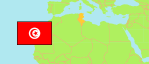
Raoued
Municipality in Tunis Agglomeration
Contents: Subdivision
The population development in Raoued as well as related information and services (Wikipedia, Google, images).
| Name | Status | Native | Population Census 2004-04-28 | Population Census 2014-04-23 | Population Census 2024-11-06 | |
|---|---|---|---|---|---|---|
| Raoued | Municipality | رواد | 60,896 | 106,414 | 141,471 | |
| Bourj Ettouil | Sector | برج الطويل | 6,985 | 7,458 | 9,261 | → |
| El Ghazala | Sector | الغزالة | 5,975 | 11,386 | 15,958 | → |
| El Medina El Fadhila | Sector | المدينة الفاضلة | 17,363 | 26,615 | 31,126 | → |
| Enkhilet | Sector | النخيلات | 7,983 | 11,352 | 13,051 | → |
| Jaafer | Sector | جعفر | 7,246 | 14,732 | 18,826 | → |
| Raoued | Sector | روّاد | 10,145 | 21,749 | 39,847 | → |
| Sidi Amor Bou Khtioua | Sector | سيدي عمر بوخطيوة | 5,199 | 13,122 | 13,402 | → |
| Tunis | Urban Agglomeration | تونس | 2,030,683 | 2,430,294 | 2,644,640 |
Source: Institut National de la Statistique Tunisie.
Explanation: Municipalities in 2020 boundaries. Area figures are computed using geospatial data.
Further information about the population structure:
| Gender (C 2024) | |
|---|---|
| Males | 71,714 |
| Females | 69,757 |
| Age Groups (C 2024) | |
|---|---|
| 0-14 years | 31,459 |
| 15-64 years | 97,700 |
| 65+ years | 12,312 |
| Age Distribution (C 2024) | |
|---|---|
| 80+ years | 1,678 |
| 70-79 years | 5,577 |
| 60-69 years | 12,055 |
| 50-59 years | 16,089 |
| 40-49 years | 21,681 |
| 30-39 years | 21,553 |
| 20-29 years | 20,767 |
| 10-19 years | 22,750 |
| 0-9 years | 19,321 |