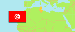
Ariana
Governorate in Tunisia
Contents: Subdivision
The population development in Ariana as well as related information and services (Wikipedia, Google, images).
| Name | Status | Native | Population Census 2004-04-28 | Population Census 2014-04-23 | Population Census 2024-11-06 | |
|---|---|---|---|---|---|---|
| Ariana | Governorate | أريانة | 422,246 | 576,088 | 668,552 | |
| Ariana | Municipality | أريانة | 97,687 | 114,486 | 109,693 | → |
| Ettadhamen | Municipality | التضامن | 78,311 | 84,312 | 79,133 | → |
| Kalâat El Andalous | Municipality | قلعة الأندلس | 23,045 | 26,796 | 32,520 | → |
| La Soukra | Municipality | سكرة | 89,151 | 129,693 | 159,862 | → |
| Mnihla | Municipality | المنيهلة | 53,752 | 89,884 | 116,327 | → |
| Raoued | Municipality | رواد | 60,896 | 106,414 | 141,471 | → |
| Sidi Thabet | Municipality | سيدي ثابت | 19,404 | 24,503 | 29,546 | → |
| Tunisie [Tunisia] | Republic | تونس | 9,910,872 | 10,982,754 | 11,972,169 |
Source: Institut National de la Statistique Tunisie.
Explanation: Municipalities take the 2015-17 municipal boundary reform and further changes into account. Area figures are computed using geospatial data.
Further information about the population structure:
| Gender (C 2024) | |
|---|---|
| Males | 333,443 |
| Females | 335,109 |
| Age Groups (C 2024) | |
|---|---|
| 0-14 years | 138,522 |
| 15-64 years | 457,631 |
| 65+ years | 72,399 |
| Age Distribution (C 2024) | |
|---|---|
| 80+ years | 11,511 |
| 70-79 years | 32,550 |
| 60-69 years | 65,806 |
| 50-59 years | 79,355 |
| 40-49 years | 101,289 |
| 30-39 years | 102,037 |
| 20-29 years | 89,651 |
| 10-19 years | 101,801 |
| 0-9 years | 84,552 |