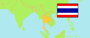
Kamphaeng Phet
Province in Thailand
Contents: Subdivision
The population development in Kamphaeng Phet as well as related information and services (Wikipedia, Google, images).
| Name | Status | Native | Population Census 2000-04-01 | Population Census 2010-09-01 | |
|---|---|---|---|---|---|
| Kamphaeng Phet | Province | จังหวัดกำแพงเพชร | 674,027 | 797,391 | |
| Bueng Samakkhi | District | อำเภอบึงสามัคคี | 22,292 | 26,786 | → |
| Khanu Woralaksaburi | District | อำเภอขาณุวรลักษบุรี | 98,091 | 107,743 | → |
| Khlong Khlung | District | อำเภอคลองขลุง | 74,510 | 78,733 | → |
| Khlong Lan | District | อำเภอคลองลาน | 55,173 | 64,567 | → |
| Kosamphi Nakhon | District | อำเภอโกสัมพีนคร | 24,505 | 30,680 | → |
| Lan Krabue | District | อำเภอลานกระบือ | 35,611 | 47,952 | → |
| Mueang Kamphaeng Phet | District | อำเภอเมืองกำแพงเพชร | 206,271 | 240,370 | → |
| Pang Sila Thong | District | อำเภอปางศิลาทอง | 28,424 | 32,185 | → |
| Phran Kratai | District | อำเภอพรานกระต่าย | 59,941 | 90,539 | → |
| Sai Ngam | District | อำเภอไทรงาม | 45,333 | 52,958 | → |
| Sai Thong Watthana | District | อำเภอทรายทองวัฒนา | 23,876 | 24,877 | → |
| Prathet Thai [Thailand] | Kingdom | ประเทศไทย | 60,916,441 | 65,981,659 |
Source: National Statistical Office (web).
