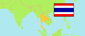
Chiang Rai
Province in Thailand
Contents: Subdivision
The population development in Chiang Rai as well as related information and services (Wikipedia, Google, images).
| Name | Status | Native | Population Census 2000-04-01 | Population Census 2010-09-01 | |
|---|---|---|---|---|---|
| Chiang Rai | Province | จังหวัดเชียงราย | 1,129,701 | 1,172,928 | |
| Chiang Khong | District | อำเภอเชียงของ | 60,996 | 61,321 | → |
| Chiang Saen | District | อำเภอเชียงแสน | 48,310 | 49,026 | → |
| Doi Luang | District | อำเภอดอยหลวง | 20,644 | 17,233 | → |
| Khun Tan | District | อำเภอขุนตาล | 31,480 | 31,041 | → |
| Mae Chan | District | อำเภอแม่จัน | 106,751 | 97,930 | → |
| Mae Fa Luang | District | อำเภอแม่ฟ้าหลวง | 61,888 | 67,061 | → |
| Mae Lao | District | อำเภอแม่ลาว | 28,793 | 29,530 | → |
| Mae Sai | District | อำเภอแม่สาย | 76,673 | 84,843 | → |
| Mae Suai | District | อำเภอแม่สรวย | 71,854 | 77,710 | → |
| Mueang Chiang Rai | District | อำเภอเมืองเชียงราย | 199,699 | 224,436 | → |
| Pa Daet | District | อำเภอป่าแดด | 24,468 | 24,605 | → |
| Phan | District | อำเภอพาน | 121,747 | 121,778 | → |
| Phaya Mengrai | District | อำเภอพญาเม็งราย | 39,964 | 39,023 | → |
| Thoeng | District | อำเภอเทิง | 76,989 | 82,687 | → |
| Wiang Chai | District | อำเภอเวียงชัย | 43,465 | 43,005 | → |
| Wiang Chiang Rung | District | อำเภอเวียงเชียงรุ้ง | 23,954 | 25,667 | → |
| Wiang Kaen | District | อำเภอเวียงแก่น | 29,362 | 30,097 | → |
| Wiang Pa Pao | District | อำเภอเวียงป่าเป้า | 62,664 | 65,935 | → |
| Prathet Thai [Thailand] | Kingdom | ประเทศไทย | 60,916,441 | 65,981,659 |
Source: National Statistical Office (web).
