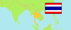
Lampang
Province in Thailand
Contents: Subdivision
The population development in Lampang as well as related information and services (Wikipedia, Google, images).
| Name | Status | Native | Population Census 2000-04-01 | Population Census 2010-09-01 | |
|---|---|---|---|---|---|
| Lampang | Province | จังหวัดลำปาง | 782,152 | 743,143 | |
| Chae Hom | District | อำเภอแจ้ห่ม | 43,057 | 40,429 | → |
| Hang Chat | District | อำเภอห้างฉัตร | 51,609 | 48,274 | → |
| Ko Kha | District | อำเภอเกาะคา | 65,165 | 60,828 | → |
| Mae Mo | District | อำเภอแม่เมาะ | 37,830 | 38,464 | → |
| Mae Phrik | District | อำเภอแม่พริก | 17,097 | 16,655 | → |
| Mae Tha | District | อำเภอแม่ทะ | 63,510 | 59,997 | → |
| Mueang Lampang | District | อำเภอเมืองลำปาง | 239,475 | 227,137 | → |
| Mueang Pan | District | อำเภอเมืองปาน | 34,037 | 31,069 | → |
| Ngao | District | อำเภองาว | 59,294 | 56,295 | → |
| Soem Ngam | District | อำเภอเสริมงาม | 33,271 | 32,280 | → |
| Sop Prap | District | อำเภอสบปราบ | 28,221 | 27,240 | → |
| Thoen | District | อำเภอเถิน | 62,518 | 61,126 | → |
| Wang Nuea | District | อำเภอวังเหนือ | 47,068 | 43,348 | → |
| Prathet Thai [Thailand] | Kingdom | ประเทศไทย | 60,916,441 | 65,981,659 |
Source: National Statistical Office (web).
