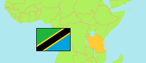
Same
District in Northern Tanzania
Contents: Subdivision
The population in Same as well as related information and services (Wikipedia, Google, images).
| Name | Status | Population Census 2022-08-23 | |
|---|---|---|---|
| Same | District | 300,303 | |
| Bangalala | Rural Ward | 4,607 | → |
| Bendera | Mixed Ward | 5,565 | → |
| Bombo | Rural Ward | 5,089 | → |
| Bwambo | Rural Ward | 9,670 | → |
| Chome | Rural Ward | 5,624 | → |
| Gavao-Saweni | Rural Ward | 3,557 | → |
| Hedaru | Mixed Ward | 22,972 | → |
| Kalemawe | Rural Ward | 5,383 | → |
| Kihurio | Mixed Ward | 10,249 | → |
| Kirangare | Rural Ward | 5,207 | → |
| Kisima | Mixed Ward | 15,037 | → |
| Kisiwani | Mixed Ward | 10,738 | → |
| Lugulu | Rural Ward | 6,449 | → |
| Mabilioni | Rural Ward | 5,854 | → |
| Makanya | Mixed Ward | 12,980 | → |
| Maore | Mixed Ward | 19,129 | → |
| Mhezi | Rural Ward | 4,618 | → |
| Mpinji | Rural Ward | 10,096 | → |
| Mshewa | Rural Ward | 5,471 | → |
| Msindo | Rural Ward | 5,810 | → |
| Mtii | Rural Ward | 5,051 | → |
| Mwembe | Mixed Ward | 6,910 | → |
| Myamba | Rural Ward | 14,360 | → |
| Ndungu | Mixed Ward | 16,436 | → |
| Njoro | Rural Ward | 5,538 | → |
| Ruvu | Rural Ward | 19,105 | → |
| Same | Mixed Ward | 10,220 | → |
| Stesheni | Mixed Ward | 9,065 | → |
| Suji | Rural Ward | 4,681 | → |
| Tae | Rural Ward | 3,935 | → |
| Vudee | Rural Ward | 6,114 | → |
| Vuje | Rural Ward | 10,828 | → |
| Vumari | Rural Ward | 6,117 | → |
| Vunta | Rural Ward | 7,838 | → |
| Northern | Zone | 8,726,288 |
Source: National Bureau of Statistics Tanzania.
Explanation: Area figures are derived from geospatial data.