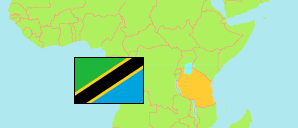
Kisarawe
District in Coastal Tanzania
Contents: Subdivision
The population in Kisarawe as well as related information and services (Wikipedia, Google, images).
| Name | Status | Population Census 2022-08-23 | |
|---|---|---|---|
| Kisarawe | District | 159,226 | |
| Boga | Rural Ward | 5,204 | → |
| Cholesamvula | Rural Ward | 9,304 | → |
| Kazimzumbwi | Mixed Ward | 7,663 | → |
| Kibuta | Rural Ward | 12,981 | → |
| Kiluvya | Mixed Ward | 24,308 | → |
| Kisarawe | Mixed Ward | 11,506 | → |
| Kurui | Rural Ward | 4,345 | → |
| Mafizi | Mixed Ward | 10,042 | → |
| Maneromango | Mixed Ward | 5,203 | → |
| Marui | Rural Ward | 7,962 | → |
| Marumbo | Rural Ward | 6,815 | → |
| Masaki | Rural Ward | 10,590 | → |
| Msanga | Mixed Ward | 7,242 | → |
| Msimbu | Mixed Ward | 18,705 | → |
| Mzenga | Rural Ward | 7,240 | → |
| Vihingo | Rural Ward | 5,245 | → |
| Vikumbulu | Rural Ward | 4,871 | → |
| Coastal | Zone | 13,434,754 |
Source: National Bureau of Statistics Tanzania.
Explanation: Area figures are derived from geospatial data.